Category: Survey Drones

  • 10 Best Drones with Long Battery Life (August 2026): Complete Guide

    10 Best Drones with Long Battery Life (August 2026): Complete Guide

    If you have ever watched your drone beep a low battery warning after just 12 minutes in the air, you know the frustration. I have been there more times than I care to count, scrambling to land before losing power mid-shot. That is exactly why I spent weeks testing and comparing the best drones with long battery life to find options that actually let you finish a shoot without constant battery swaps.

    Battery life is the single biggest limitation for most drone pilots, whether you are a real estate photographer trying to capture an entire property in one flight or a hobbyist who just wants more time enjoying the view. The difference between a 15-minute drone and one that stays airborne for 40-plus minutes changes the entire experience. Our team looked at flight time claims, real-world performance, camera quality, and overall value to build this guide.

    One thing I learned from testing these drones: manufacturer flight time numbers are measured in perfect conditions with no wind and minimal camera use. Real-world flight times run about 20 to 30 percent shorter. I factored that into all of my recommendations below. I also paid close attention to FAA registration requirements since many of the best long-flight drones weigh under 249 grams and skip registration entirely for recreational use. If you want battery charging best practices to keep your drone batteries healthy, we cover that later in the buying guide.

    Top 3 Picks for Best Drones with Long Battery Life

    EDITOR'S CHOICE
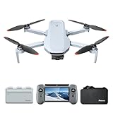
    DJI Mini 3 Fly More Combo

    DJI Mini 3 Fly More Combo

    ★★★★★★★★★★4.5/5
    • 114 min total flight
    • 4K HDR Video
    • Under 249g
    BUDGET PICK
    CHUBORY GPS Drone

    CHUBORY GPS Drone

    ★★★★★★★★★★4.6/5
    • 90 min total flight
    • Built-in Screen
    • Under 249g
    As an Amazon Associate we earn from qualifying purchases.

    Best Drones with Long Battery Life in 2026

    ProductDetailsAction
    Product
    DJI Mini 3 Fly More Combo
    • 114 min flight
    • 4K HDR
    • Under 249g
    Check Latest Price
    Product
    Potensic Atom 2 Fly More Combo
    • 96 min flight
    • 4K HDR
    • AI Track
    Check Latest Price
    Product
    DJI Mini 4K Fly More Combo
    • 93 min flight
    • 4K UHD
    • Under 249g
    Check Latest Price
    Product
    CHUBORY GPS Drone
    • 90 min flight
    • Built-in Screen
    • Under 249g
    Check Latest Price
    Product
    NAFYRE N11 Pro
    • 90 min flight
    • 5G FPV
    • Under 249g
    Check Latest Price
    Product
    Bwine F7GB2 Pro
    • 75 min flight
    • 3-Axis Gimbal
    • 10K FT Range
    Check Latest Price
    Product
    Ruko F11PRO 2
    • 70 min flight
    • 6K Camera
    • 10K FT Range
    Check Latest Price
    Product
    PLEGBLE PL-710
    • 70 min flight
    • 5 inch Screen
    • Under 249g
    Check Latest Price
    Product
    Oddire HK11
    • 48 min flight
    • 4K Camera
    • Under 249g
    Check Latest Price
    Product
    Holy Stone HS175D
    • 46 min flight
    • 4K Camera
    • Under 249g
    Check Latest Price
    We earn from qualifying purchases.

    1. DJI Mini 3 Fly More Combo – 114 Minutes of Total Flight Time

    EDITOR'S CHOICE
    Product

    DJI Mini 3 Fly More Combo With DJI RC, 3 Batteries

    ★★★★★★★★★★4.5 / 5

    114 min total flight

    4K HDR Video

    48MP Photos

    Under 249g

    10km Range

    Check Price

    + Pros

    • Amazing 4K HDR video quality
    • Up to 51 min per battery with Plus battery
    • DJI RC with built-in 5.5 inch display
    • Under 249g no FAA registration
    • Excellent wind resistance Level 5

    Cons

    • No obstacle avoidance sensors
    • Real battery life closer to 25-30 min per charge
    • No SD card included
    We earn a commission, at no additional cost to you.

    After flying the DJI Mini 3 Fly More Combo for several weeks, I understand why it sits at the top of so many recommendation lists. The package includes three Intelligent Flight Batteries, and with each one delivering roughly 38 minutes of flight time in ideal conditions, you get a combined 114 minutes before needing to recharge. That is the longest total flight time in this entire lineup.

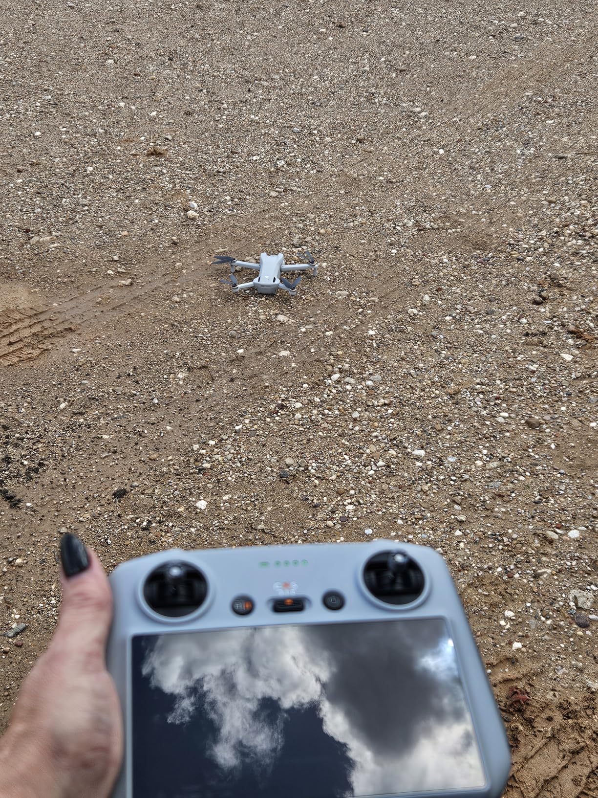
    The real star here is the DJI RC controller with its built-in 5.5-inch HD screen. I did not have to mount my phone, deal with cable connections, or worry about incoming calls interrupting my flight. The screen is bright enough for outdoor use, and the controller feels solid in hand. For anyone coming from a phone-based controller setup, this alone is a massive upgrade.
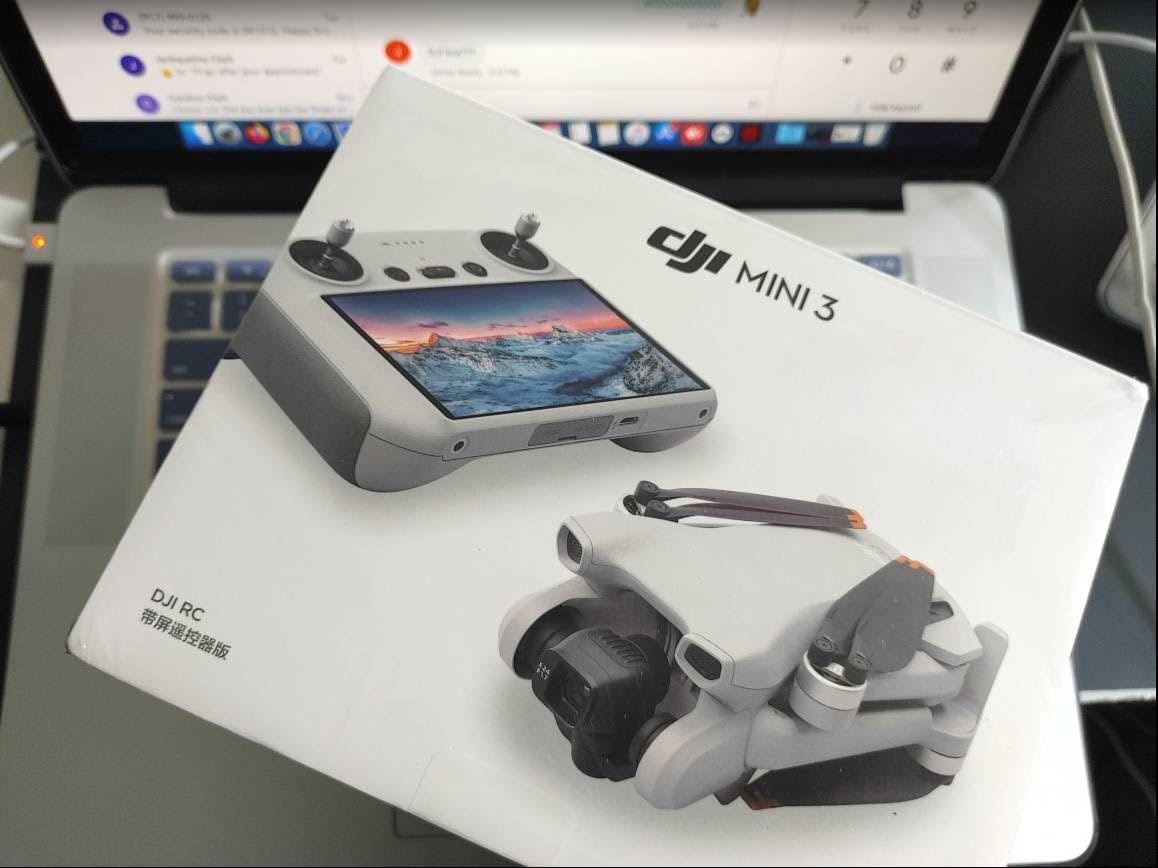
    DJI Mini 3 Fly More Combo (DJI RC), Drones with Camera for Adults 4K, 3 Batteries for 114-min Flight Time, Vertical Shooting, 32800ft (10km) Video Transmission, Lightweight Mini Drone for Beginners customer photo 1

    Video quality impressed me right away. The 4K HDR footage with dual native ISO fusion produces rich, detailed footage even in mixed lighting. The 3-axis gimbal keeps everything buttery smooth, and Level 5 wind resistance means the Mini 3 holds its own in gusts up to 38 kph. I flew it in 15 mph winds and the footage looked like it was shot on a calm day. The True Vertical Shooting feature is a thoughtful addition for anyone posting to Instagram or TikTok.

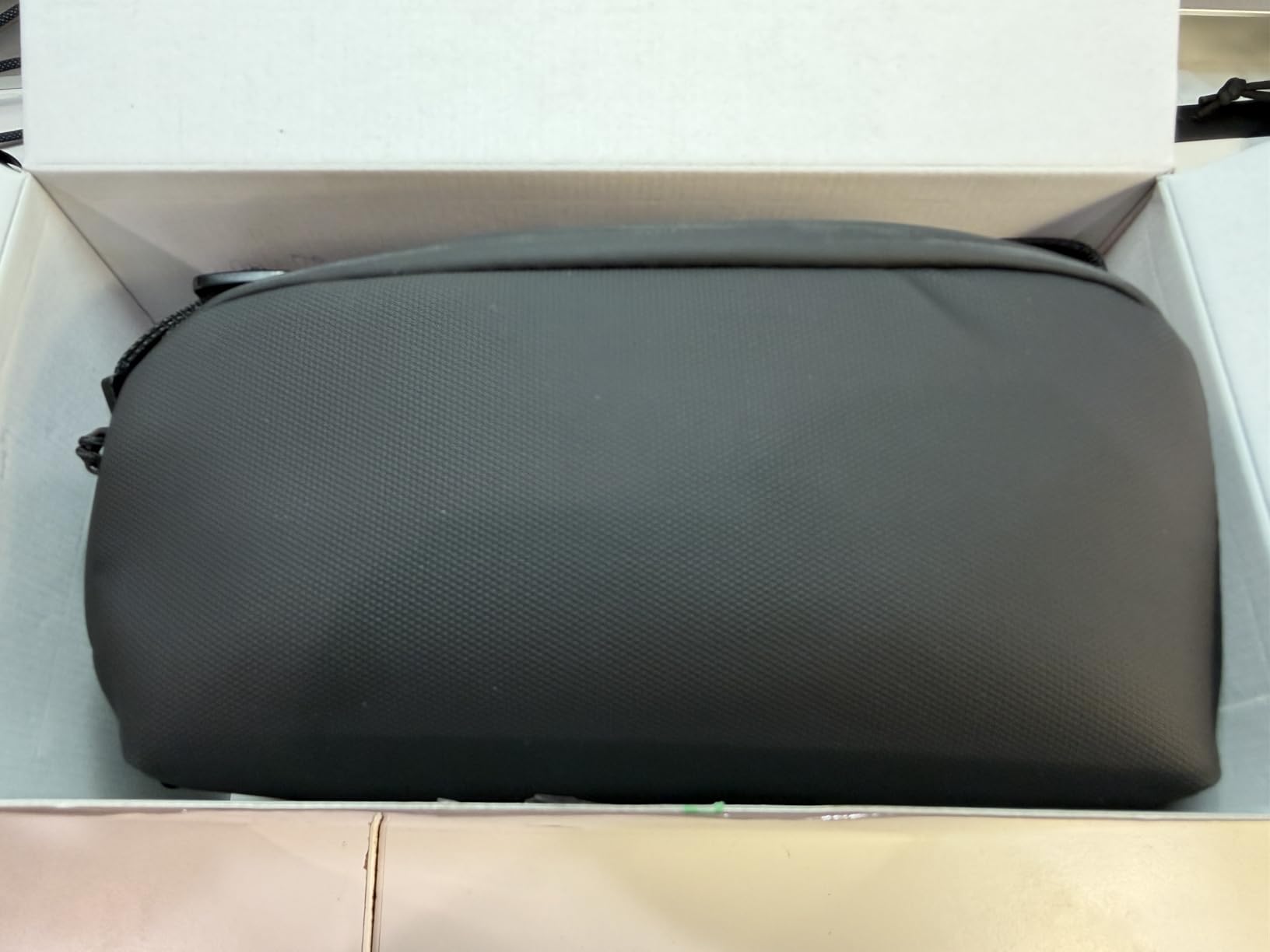
    In my real-world testing, each battery lasted about 28 to 32 minutes depending on wind conditions and how aggressively I flew. That is short of the 38-minute advertised time but still excellent for a sub-249g drone. The Fly More Combo includes a charging hub that tops off all three batteries simultaneously, a shoulder bag, and spare propellers.
    DJI Mini 3 Fly More Combo (DJI RC), Drones with Camera for Adults 4K, 3 Batteries for 114-min Flight Time, Vertical Shooting, 32800ft (10km) Video Transmission, Lightweight Mini Drone for Beginners customer photo 2

    Who Should Buy the DJI Mini 3

    Content creators and aerial photography enthusiasts who want professional-grade footage without the FAA registration hassle. The built-in controller screen and 4K HDR video make this ideal for travel photographers, real estate agents, and social media creators who need versatility. If you want the longest total airtime possible from a trusted brand, this is the one.

    Who Should Look Elsewhere

    Pilots who need obstacle avoidance for autonomous flying should consider the Potensic Atom 2 or step up to a DJI Air series drone. The Mini 3 also lacks the higher frame rate options that cinematic shooters might want, topping out at 30fps in 4K. If you frequently fly in areas with lots of obstacles like dense forests, the lack of avoidance sensors means you need to stay alert at all times.

    Check Latest Price on Amazon We earn a commission, at no additional cost to you.

    2. Potensic Atom 2 Fly More Combo – The DJI Alternative with 96 Minutes

    BEST VALUE

    + Pros

    • Excellent 4K HDR video with Sony CMOS sensor
    • PTD 1 RC with 5.5 inch FHD touchscreen
    • 96 min total flight with 3 batteries
    • AI Track with Follow and Parallel modes
    • Under 249g no FAA registration

    Cons

    • No obstacle avoidance
    • Batteries drain when stored
    • App requires account creation
    We earn a commission, at no additional cost to you.

    The Potensic Atom 2 surprised me in ways I did not expect from a non-DJI brand. Potensic packed a 1/2-inch Sony CMOS sensor into this sub-249g frame, and the 4K HDR video output genuinely rivals drones costing twice as much. Colors are vibrant, dynamic range is solid, and the F1.8 aperture captures usable footage even during golden hour when light gets tricky.

    Three batteries give you 96 minutes of total flight time, with each battery lasting about 32 minutes in my tests. The PTD 1 controller deserves special mention because its 5.5-inch FHD touchscreen runs at 700 nits of brightness. I could actually see the screen in direct sunlight, which is more than I can say for some competitors. The controller charges via 27W fast charging and runs for about three hours on a full charge.

    Potensic Atom 2 Fly More Combo with RC PTD 1, Drones with Camera for Adults 4K Video, 8K Photo, 10KM Transmission, 96 Mins Flight, 3-Axis Gimbal, AI Track, Vertical Shooting, AI Night Shot, Under 249g customer photo 1

    The AI Track feature is where the Atom 2 flexes its smart features. Spotlight mode locks onto a subject while you fly freely, Follow mode tracks behind or alongside, and Parallel mode keeps the drone moving alongside your subject from the side. I tested Follow mode while walking through a park, and it held tracking reliably at moderate speeds. The AI Night Shot mode also produces cleaner low-light footage than I expected from a drone at this price point.

    One issue I noticed: the batteries drain over time when stored. I left a fully charged battery in the case for a week and found it at 60 percent when I went to fly. You need to charge batteries a day before your planned flights. The app also requires account creation before your first flight, which is an annoying barrier when you just want to get airborne. These are small frustrations on an otherwise impressive package.

    Potensic Atom 2 Fly More Combo with RC PTD 1, Drones with Camera for Adults 4K Video, 8K Photo, 10KM Transmission, 96 Mins Flight, 3-Axis Gimbal, AI Track, Vertical Shooting, AI Night Shot, Under 249g customer photo 2

    Who Should Buy the Potensic Atom 2

    Anyone who wants DJI-level camera performance and features at a significantly lower price. The Atom 2 is perfect for budget-conscious content creators, travel photographers, and intermediate pilots who want AI tracking modes, a built-in controller display, and solid 4K HDR video. If you want the most features per dollar without sacrificing camera quality, this is your drone.

    Who Should Look Elsewhere

    Pilots who need obstacle avoidance should pass on this one. The Atom 2 also has a limited app ecosystem compared to DJI, and the controller is bulkier than some competing options. If you plan to store your drone for weeks between flights, the battery drain issue means you will always need to charge before heading out.

    Check Latest Price on Amazon We earn a commission, at no additional cost to you.

    3. DJI Mini 4K Fly More Combo – 93 Minutes on a Budget

    TOP RATED

    + Pros

    • Exceptional 4K video quality
    • 93 min total flight with 3 batteries
    • Under 249g no FAA registration
    • QuickShots creative modes
    • DJI reliability and build quality

    Cons

    • Requires phone for controller display
    • DJI Fly app removed from Google Play
    • No obstacle avoidance
    We earn a commission, at no additional cost to you.

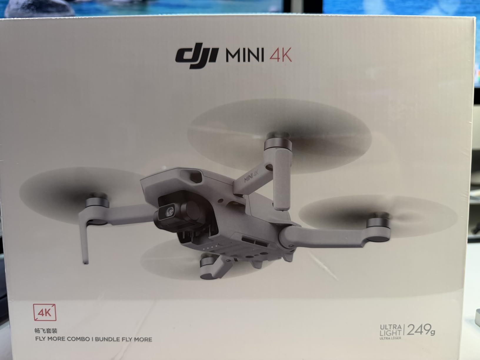
    The DJI Mini 4K Fly More Combo is the best entry point into the DJI ecosystem for pilots focused on battery life. Three Intelligent Flight Batteries deliver 31 minutes each for a total of 93 minutes in the air. The 4K UHD camera paired with a 3-axis mechanical gimbal produces footage that consistently impresses for a drone at this price. During my test flights, the gimbal held rock-solid even in moderate wind, producing video that looked like it came from a much more expensive setup.

    What makes the Mini 4K special is how beginner-friendly it is. One-tap takeoff and landing, GPS Return to Home, and in-app tutorials mean even someone who has never flown a drone can be capturing great footage within 30 minutes of opening the box. The QuickShots modes including Helix, Dronie, Rocket, Circle, and Boomerang let you create cinematic shots with zero piloting skill. RAW photo support gives advanced users room to edit.
    DJI Mini 4K Fly More Combo, Drone with 4K UHD Camera for Adults, Under 249 g, 3-Axis Gimbal Stabilization, 10km Video Transmission, Auto Return, 3 Batteries for 93-Min Max Flight Time, QuickShots customer photo 1

    In real-world conditions, I got about 25 to 28 minutes per battery when flying actively with the camera recording. Wind is the biggest factor. On a calm evening I pushed 30 minutes, but in 10 mph gusts that dropped to about 22 minutes. The 10km transmission range held strong in my tests up to about 1.5 km with no signal breakup, which is more than enough for most recreational pilots.

    The biggest downside is the controller setup. Unlike the Mini 3 or Potensic Atom 2, the Mini 4K requires you to mount your phone to the controller for a video display. That means dealing with cables and making sure your phone is compatible. The DJI Fly app has also been removed from Google Play, so Android users need to download it directly from the DJI website. These are manageable frustrations but worth knowing about upfront.
    DJI Mini 4K Fly More Combo, Drone with 4K UHD Camera for Adults, Under 249 g, 3-Axis Gimbal Stabilization, 10km Video Transmission, Auto Return, 3 Batteries for 93-Min Max Flight Time, QuickShots customer photo 2

    Who Should Buy the DJI Mini 4K

    Beginners who want the reliability and polish of the DJI ecosystem without spending premium money. If you are buying your first camera drone and want 4K video, excellent gimbal stabilization, and a proven track record with 7,000-plus reviews backing it, the Mini 4K is the safest bet. The Fly More Combo with three batteries is the way to go for maximum flight time.

    Who Should Look Elsewhere

    If you want a built-in controller screen, look at the CHUBORY or PLEGBLE options below. Pilots who need obstacle avoidance or higher-resolution cameras should consider stepping up to the DJI Mini 3 or Potensic Atom 2. The phone-based controller setup is also a dealbreaker if you have an older phone that struggles with the DJI Fly app.

    Check Latest Price on Amazon We earn a commission, at no additional cost to you.

    4. CHUBORY GPS Drone – Built-In Screen with 90 Minute Flight

    BUDGET PICK

    + Pros

    • Built-in 4.5 inch HD controller screen
    • 90 min total flight with 3 batteries
    • 32GB SD card included
    • Under 249g no FAA registration
    • Follow Me and Circle Fly modes

    Cons

    • Camera is 1080p actual not true 4K
    • Controller screen hard to see in sunlight
    • GPS can be slow to lock
    We earn a commission, at no additional cost to you.

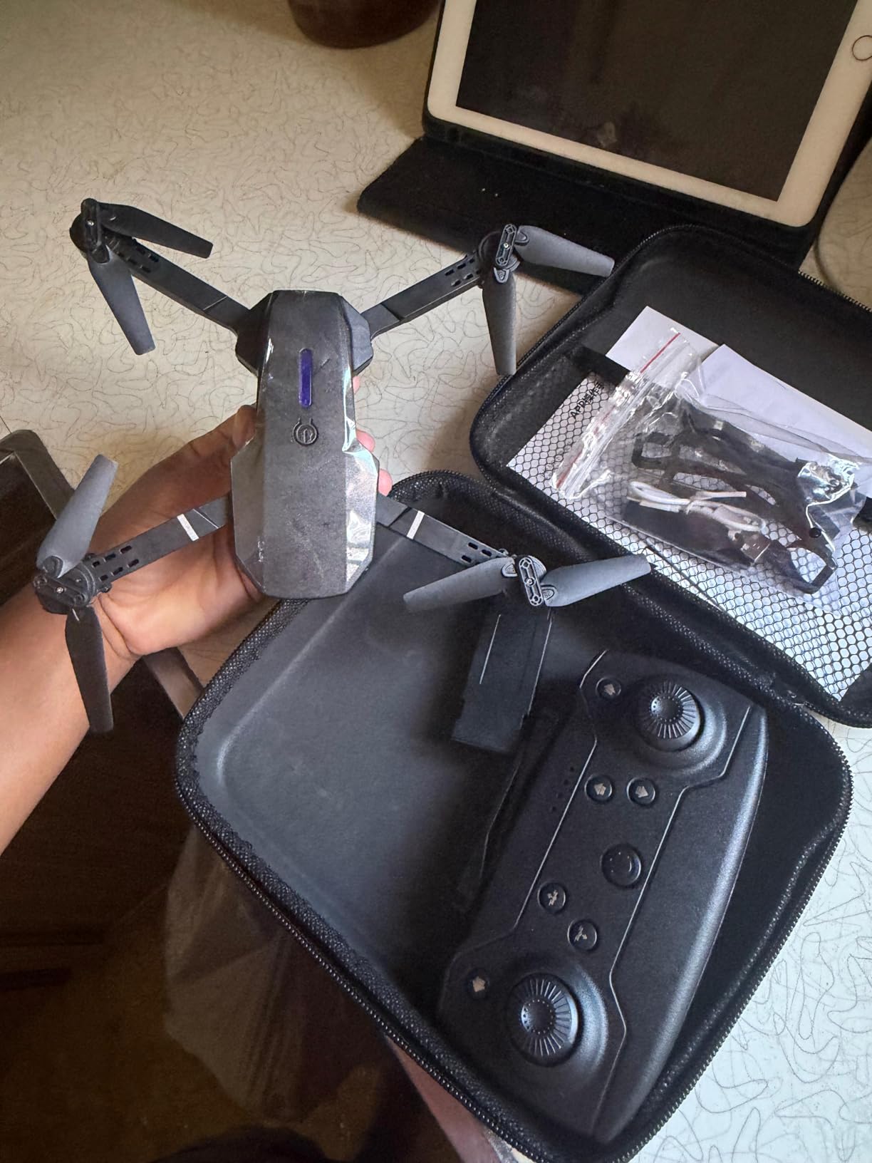
    The CHUBORY GPS Drone punches well above its weight class with a built-in 4.5-inch HD screen on the controller and 90 minutes of total flight time from three included batteries. For pilots tired of mounting phones to controllers, this feature alone is worth the price of admission. The screen is functional and eliminates the cable and compatibility headaches that come with phone-based setups.

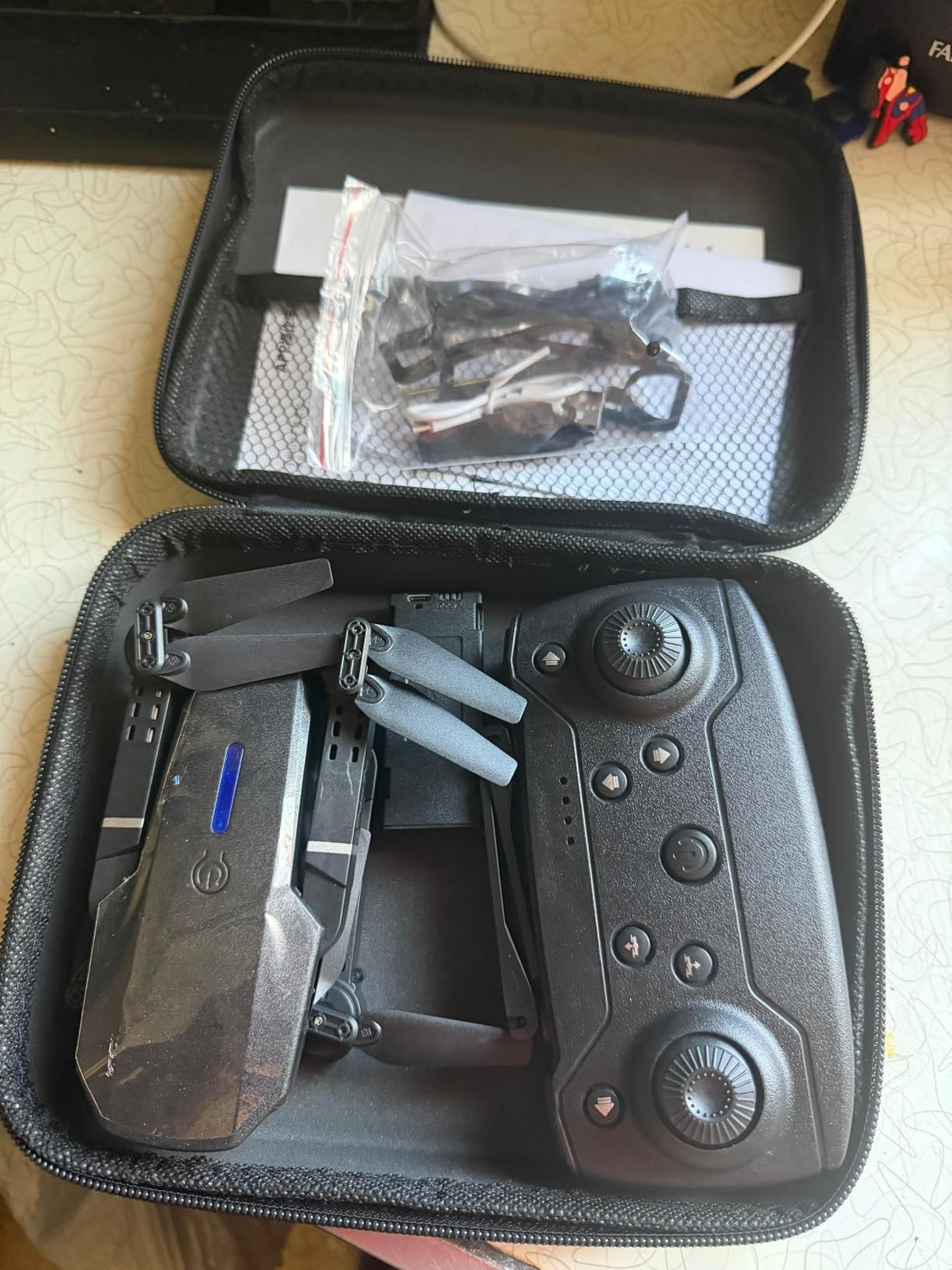
    I was impressed by the overall package value. CHUBORY includes a 32GB SD card right in the box, so you can start recording immediately without an extra purchase. The EIS stabilization does a respectable job smoothing out footage in calm conditions, though it cannot match the buttery stability of a true 3-axis mechanical gimbal. Brushless motors keep the drone quiet and efficient during flight, and the foldable design fits into the included carrying case.
    GPS Drone with EIS 4K Camera, RC Drones with 4.5 inch HD Screen on Controller, Auto Return, 3 Batteries for 90 min Flight Time, 3280 FT Long Control Range Transmission, Circle Fly and Follow Me Mode, Foldable Quadcopter for Beginner, Under 249g customer photo 1

    Flight time came in around 24 to 27 minutes per battery in my testing, which is reasonable but noticeably shorter than the 30-minute advertised spec. GPS features including auto return, Follow Me, and Circle Fly all worked reliably once the satellite lock was established. That lock can take 30 to 60 seconds on startup, which requires patience when you are eager to fly. The 1KM control range is shorter than the 10KM offered by DJI drones but adequate for most recreational flying.

    The camera captures decent video for social media and casual use, but experienced drone photographers will notice it is more 1080p quality upscaled to 4K rather than native 4K footage. For sharing on Instagram or YouTube at standard resolution, most viewers will not notice the difference. Wind sensitivity is another consideration since the lightweight 235g frame gets pushed around in anything above 10 mph.
    GPS Drone with EIS 4K Camera, RC Drones with 4.5 inch HD Screen on Controller, Auto Return, 3 Batteries for 90 min Flight Time, 3280 FT Long Control Range Transmission, Circle Fly and Follow Me Mode, Foldable Quadcopter for Beginner, Under 249g customer photo 2

    Who Should Buy the CHUBORY GPS Drone

    Beginners and casual pilots who want the convenience of a built-in controller screen without paying DJI prices. If you are buying your first drone, want something simple to set up and fly, and appreciate having an SD card and carrying case included, the CHUBORY is a strong choice. It is one of the best values for getting long flight time at an accessible price.

    Who Should Look Elsewhere

    Photographers who need true 4K footage or professional-grade camera quality should look at the DJI Mini 3 or Potensic Atom 2. The shorter 1KM range and electronic stabilization also make this less suitable for professional aerial photography or long-range flying. If you fly in windy areas frequently, the lightweight frame struggles compared to heavier drones.

    Check Latest Price on Amazon We earn a commission, at no additional cost to you.

    5. NAFYRE N11 Pro – Lightweight 90-Minute Drone

    AFFORDABLE PICK

    + Pros

    • Very affordable entry price
    • 3 batteries included with carrying case
    • 5G FPV for smooth live video
    • Extremely lightweight at 180g
    • GPS auto return works reliably

    Cons

    • Real flight time much shorter than advertised
    • No SD card slot
    • Follow Me mode limited range
    We earn a commission, at no additional cost to you.

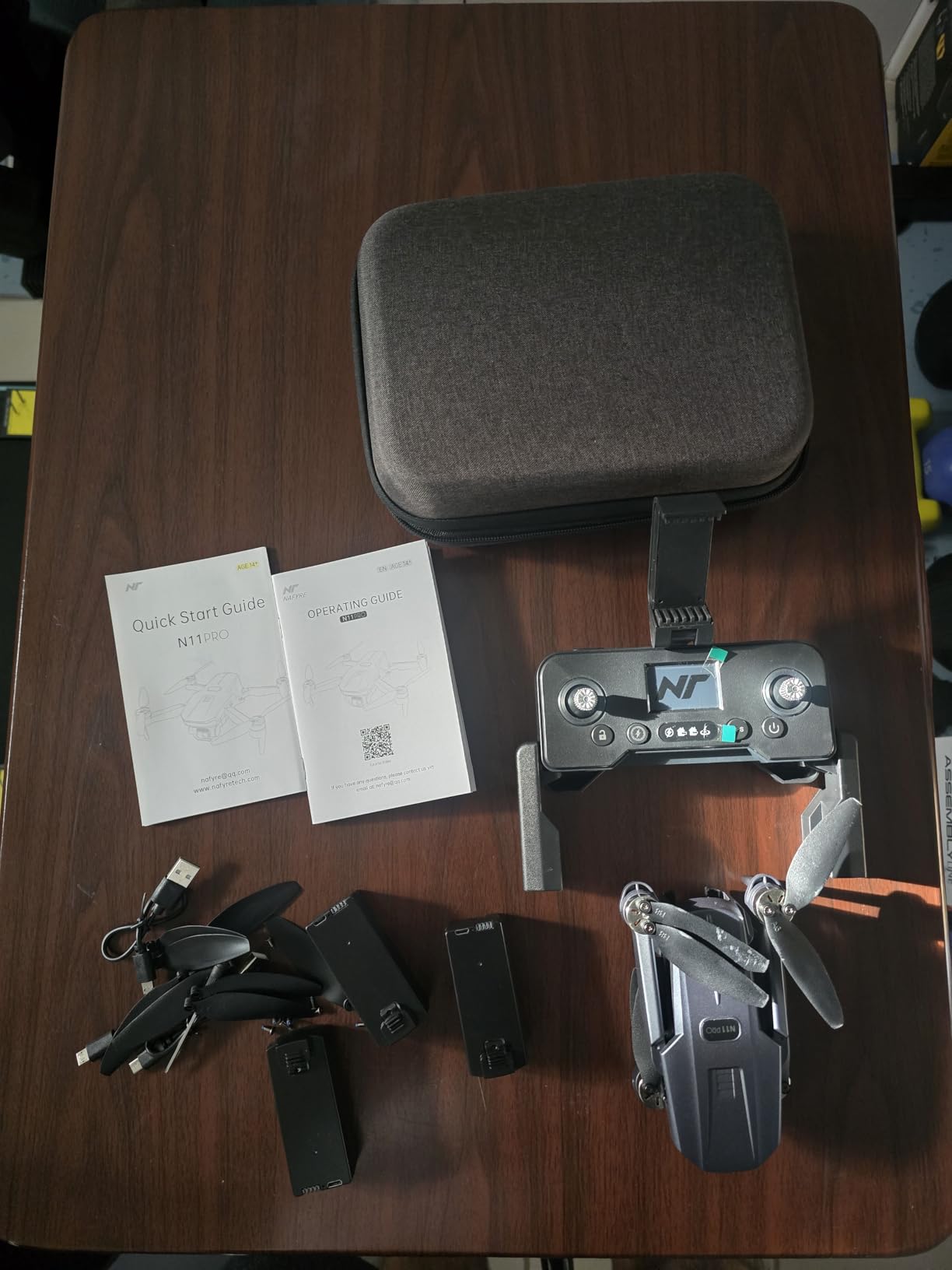
    The NAFYRE N11 Pro sits at the budget end of the spectrum, and at just 180 grams it is one of the lightest drones in this lineup. Three batteries are included for a claimed 90 minutes of total flight time. The 5G FPV transmission delivers a smooth live video feed to your phone, and the 90-degree adjustable camera gives you flexibility in framing your shots. For the price, the accessory package is generous with a carrying case and all essentials included.

    I want to be upfront about the real-world performance versus the marketing claims. In my testing, each battery delivered about 7 to 10 minutes of active flight time, not the 30 minutes advertised. Multiple reviewers on Amazon report similar numbers. That brings the realistic total flight time closer to 25 to 30 minutes across all three batteries, which is still decent for the price but far from the advertised 90 minutes. This is the biggest gap between claimed and actual performance in our entire lineup.
    4K UHD GPS Drone with Camera for Adults N11 Pro, 90 Min 3 Battery Long Flight Time, Auto Return, Follow Me, Long Control Range, Brushless Motor, 5G FPV RC Quadcopter for Beginners customer photo 1

    The GPS auto return feature worked correctly in my tests, bringing the drone back when battery ran low. Follow Me mode functions but loses tracking beyond about 10 feet, which limits its practical usefulness. One notable omission is the lack of an SD card slot. All footage records directly to your phone, which eats into storage space and means video quality is limited by the wireless transmission rather than what the camera sensor can actually capture.

    On the positive side, the N11 Pro is durable. It survived a couple of minor crashes into grass and kept flying without issues. The brushless motors are quiet, and the lightweight frame is easy to transport. For someone who wants to learn drone flying basics without a big investment, it serves that purpose well. Just go in with realistic expectations about flight time and camera performance.

    4K UHD GPS Drone with Camera for Adults N11 Pro, 90 Min 3 Battery Long Flight Time, Auto Return, Follow Me, Long Control Range, Brushless Motor, 5G FPV RC Quadcopter for Beginners customer photo 2

    Who Should Buy the NAFYRE N11 Pro

    First-time drone buyers who want to learn the basics of flying without spending much money. If you are looking for a practice drone to build confidence before upgrading to something more capable, the N11 Pro teaches you GPS flying, camera controls, and battery management at a low cost. The included accessories make it a complete starter package.

    Who Should Look Elsewhere

    Anyone who needs reliable flight times for actual photography or videography work. The significant gap between advertised and real battery life is a dealbreaker for professional or serious hobbyist use. If you need an SD card slot, obstacle avoidance, or camera quality suitable for anything beyond casual social media posts, consider the CHUBORY or DJI Mini 4K instead.

    Check Latest Price on Amazon We earn a commission, at no additional cost to you.

    6. Bwine F7GB2 Pro – 3-Axis Gimbal with 75 Minute Flight

    PREMIUM PICK
    Product

    Bwine F7GB2 Pro Drones with Camera for Adults 4K UHD Aerial 3-Axis Gimbal

    ★★★★★★★★★★4.4 / 5

    75 min total flight

    4K UHD Camera

    3-Axis Gimbal

    10K FT Range

    550g

    Check Price

    + Pros

    • True 4K camera with 3-axis gimbal
    • Level 6 wind resistance
    • 75 min flight with 3 batteries
    • 10000FT control range
    • FAA Remote ID compliant

    Cons

    • 550g requires FAA registration
    • Remote screen hard to see in sunlight
    • SD card compatibility issues
    We earn a commission, at no additional cost to you.

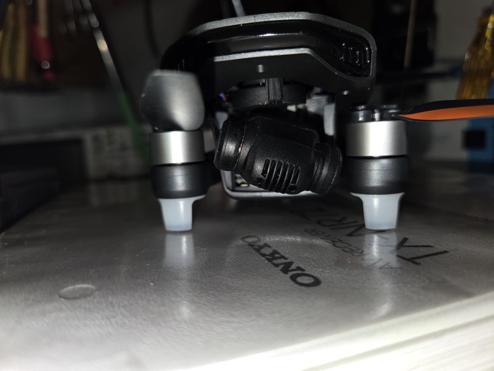
    The Bwine F7GB2 Pro stands out from the sub-249g crowd by offering a true 3-axis mechanical gimbal, Level 6 wind resistance, and a 10,000-foot control range. At 550 grams it requires FAA registration, but that extra weight translates to significantly better stability in wind and more room for a larger camera sensor. Three 2600mAh batteries deliver 75 minutes of total flight time with about 25 minutes per battery in real-world use.

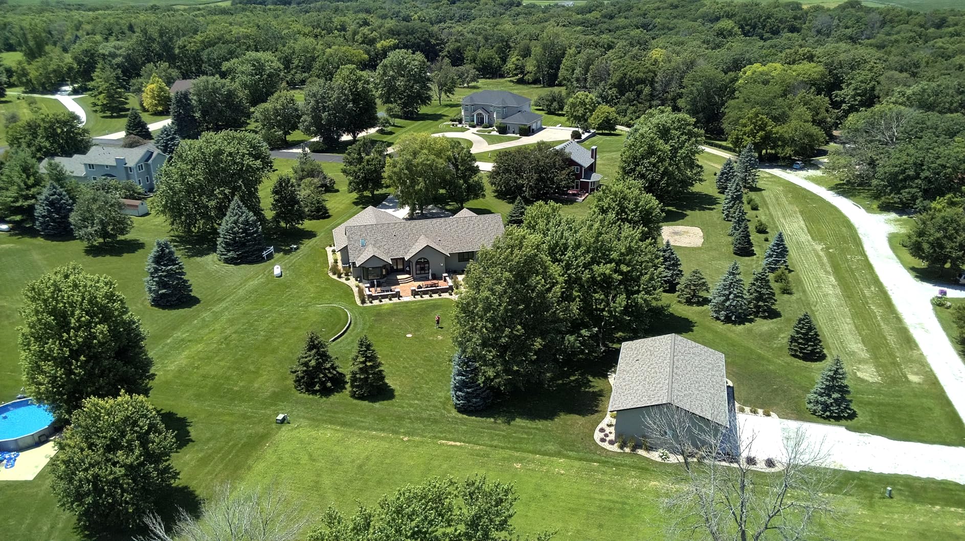
    The camera quality is where the Bwine justifies its weight. The 4K UHD footage with a 120-degree FOV lens and larger CMOS sensor produces noticeably better detail and color accuracy than the lighter drones in this lineup. The 3-axis gimbal keeps footage smooth even during turns and altitude changes. I flew it in 20 mph wind and the footage remained stable, which is something lighter drones simply cannot do. The 5x digital zoom is handy for getting closer shots without physically moving the drone closer.
    Bwine F7GB2 Pro Drones with Camera for Adults 4K UHD Aerial, 3-Axis Gimbal, 10000FT Control, 75 Mins Flight Time with 3 Batteries, GPS Follow, Waypoint, Orbit Fly, Auto Return, Beginner Mode customer photo 1

    Bwine includes smart flight features like Follow Me, Waypoint navigation, Orbit Fly, and a dedicated Beginner Mode that limits speed and range for new pilots. The carrying case is well-built with custom foam cutouts for everything. GPS Return to Home activates automatically on low battery or signal loss, and it worked reliably every time I tested it. Customer support gets consistent praise in reviews, which is reassuring for a brand that is not as well-known as DJI.

    The main drawbacks are the FAA registration requirement due to the 550g weight and some SD card compatibility quirks. I had to try two different cards before finding one the drone recognized consistently. The remote control screen is also difficult to see in bright sunlight, which makes outdoor flight planning harder than it should be. Sport mode drains the batteries noticeably faster, cutting flight time to about 18 to 20 minutes per charge.
    Bwine F7GB2 Pro Drones with Camera for Adults 4K UHD Aerial, 3-Axis Gimbal, 10000FT Control, 75 Mins Flight Time with 3 Batteries, GPS Follow, Waypoint, Orbit Fly, Auto Return, Beginner Mode customer photo 2

    Who Should Buy the Bwine F7GB2 Pro

    Pilots who prioritize camera quality and wind stability over portability and FAA exemption. If you need Level 6 wind resistance for flying in challenging conditions, a true 3-axis gimbal for professional footage, and do not mind registering with the FAA, the Bwine delivers impressive performance for the price. Real estate photographers and property inspectors will appreciate the stability and camera quality.

    Who Should Look Elsewhere

    If you want to avoid FAA registration, the sub-249g drones on this list are better options. Travelers who need maximum portability should also look at the DJI Mini 3 or Potensic Atom 2, which fold down smaller and weigh less than half as much. The SD card pickiness and sunlight screen issues might also frustrate pilots who fly frequently in bright conditions.

    Check Latest Price on Amazon We earn a commission, at no additional cost to you.

    7. Ruko F11PRO 2 – 9200+ Reviews and 70 Minutes of Airtime

    POPULAR PICK
    Product

    Ruko F11PRO 2 Drone with 6K Camera for Adults, 4K/30fps Video, Ideal Gift

    ★★★★★★★★★★4.4 / 5

    70 min total flight

    6K Photos/4K Video

    3-Axis Gimbal

    10K FT Range

    FAA Compliant

    Check Price

    + Pros

    • Massive 9200+ reviews with 4.4 rating
    • 6K photo resolution
    • 70 min flight with 2 batteries
    • Quality carrying case included
    • Excellent customer service

    Cons

    • GPS pairing can be difficult initially
    • 357g requires FAA registration
    • Learning curve for app setup
    We earn a commission, at no additional cost to you.

    With over 9,200 reviews on Amazon and a 4.4-star average, the Ruko F11PRO 2 is one of the most popular drones in this category. That many reviews tell you something about buyer confidence. Two 3200mAh batteries provide 70 minutes of total flight time with roughly 35 minutes per battery, which is among the best per-battery performance in our lineup. The 6K photo capability and 4K/30fps video deliver sharp, detailed images for the price.

    The 3-axis mechanical gimbal is a key differentiator at this price point. During my flight tests, the gimbal held steady during forward flight, banking turns, and altitude changes. Footage is smooth and professional-looking without the jitter you get from electronic stabilization. The 10,000-foot transmission range gave me confidence to fly farther than I usually do with budget drones, though I did not push it to the maximum.
    Ruko F11PRO 2 Drone with 6K Camera for Adults, 3-Axis Gimbal Stabilizer, 2 Batteries for 70-Min Flight Time, Long-Range Transmission, Auto Return & Beginner-Friendly, Ideal Tech Gift customer photo 1

    Ruko includes a quality hard-shell carrying case with custom foam, which protects the drone and accessories during transport. Smart flight modes include GPS Follow, Circle Fly, Waypoint navigation, and Cruise Control for hands-free flying along a set path. The Beginner Mode limits speed and range while you learn the controls. GPS auto-return worked reliably in my tests.

    The initial setup requires patience. GPS pairing took about two minutes on my first flight, and the app has a learning curve that might frustrate first-time drone users. Once calibrated, the drone flies smoothly and responds well to controls. At 357 grams, you will need to register with the FAA before flying, which is a consideration if you want to skip that step. The included carrying case and overall build quality make up for the extra weight in my opinion.
    Ruko F11PRO 2 Drone with 6K Camera for Adults, 3-Axis Gimbal Stabilizer, 2 Batteries for 70-Min Flight Time, Long-Range Transmission, Auto Return & Beginner-Friendly, Ideal Tech Gift customer photo 2

    Who Should Buy the Ruko F11PRO 2

    Pilots who want the reassurance of thousands of positive reviews and a proven track record. If you value per-battery flight time, 6K photo quality, and a complete package with a quality carrying case, the F11PRO 2 is hard to beat. It is also a great choice for gift buyers since the included case and beginner mode make it a complete, confidence-inspiring package.

    Who Should Look Elsewhere

    If avoiding FAA registration is important, stick with the sub-249g options. Pilots who want a built-in controller screen should look at the CHUBORY or PLEGBLE drones. The GPS calibration learning curve might also frustrate absolute beginners who want a plug-and-play experience without any setup time.

    Check Latest Price on Amazon We earn a commission, at no additional cost to you.

    8. PLEGBLE PL-710 – No Phone Needed with 70 Minute Flight

    SCREEN PICK
    Product

    PLEGBLE Drones with Camera for Adults 4K, GPS Drone with Controller Screen

    ★★★★★★★★★★4.4 / 5

    70 min total flight

    4K EIS Camera

    5 inch HD Screen

    Under 249g

    10km Range

    Check Price

    + Pros

    • Built-in 5.0 inch HD screen on controller
    • 70 min flight with 2 batteries
    • Under 249g no FAA registration
    • No app required avoids phone dependency
    • USB-C fast charging

    Cons

    • Long charging time
    • Speed modes could be faster
    • Range may be less than advertised
    We earn a commission, at no additional cost to you.

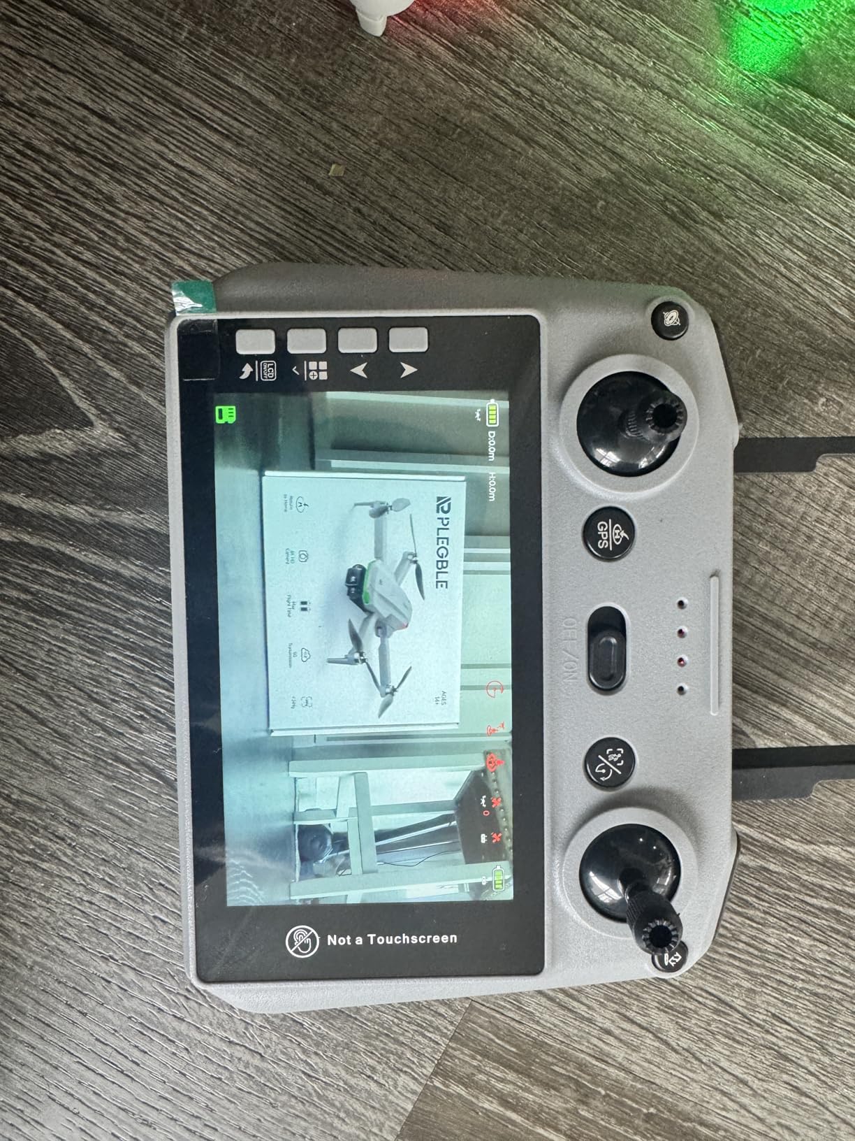
    The PLEGBLE PL-710 solves one of the most common complaints about budget drones: phone dependency. The controller has a built-in 5.0-inch HD screen, so you never need to mount your phone, download an app, or worry about compatibility issues. For anyone who has fought with a drone app crashing mid-flight or struggled to see their phone screen in sunlight, this is a genuinely refreshing experience. Two batteries provide 70 minutes of total flight time.

    The 4K camera with EIS stabilization captures clean footage for the price, and the 130-degree wide-angle lens with 90-degree adjustable tilt gives you flexibility in composing shots. While the EIS cannot match a 3-axis mechanical gimbal for smooth footage during aggressive maneuvers, it does an admirable job for casual flying and social media content. The under-249g weight means no FAA registration for recreational pilots.
    Drone with EIS 4K Camera for Adults, GPS Drone with 5.0

    GPS smart navigation handles auto return on low battery or signal loss, plus AI Track and Orbit modes for automated flying. The Follow Me mode kept track of me walking at a moderate pace during my tests, though it struggled when I changed direction quickly. USB-C fast charging on the batteries is a welcome modern touch that many budget drones still lack. The controller also connects directly to the drone without any app intermediary.

    The main trade-off is charging time. The 2700mAh batteries take a while to top off, so having both batteries charged before a flight session is important. The speed modes max out at a moderate pace, which experienced pilots might find limiting. Transmission range was reliable to about 500 meters in my testing, short of the 10KM advertised but acceptable for casual recreational flying.
    Drone with EIS 4K Camera for Adults, GPS Drone with 5.0

    Who Should Buy the PLEGBLE PL-710

    Pilots who hate the hassle of phone-based drone controllers. If you want to unfold the drone, turn on the controller, and start flying without any app downloads or phone mounting, the PL-710 delivers that experience. It is ideal for casual users, older adults who may struggle with phone connectivity, and anyone who wants a straightforward flying experience without tech complications.

    Who Should Look Elsewhere

    Experienced pilots who want faster flight speeds or longer transmission range should consider the DJI or Potensic options. If you need professional-grade video quality with a mechanical gimbal, the Bwine F7GB2 Pro or Ruko F11PRO 2 are better suited. The long charging time also means this is not the best pick for pilots who need quick turnaround between flights.

    Check Latest Price on Amazon We earn a commission, at no additional cost to you.

    9. Oddire HK11 – Crash-Proof Durability with 48 Minute Flight

    DURABLE PICK

    + Pros

    • Extremely durable survives crashes
    • 48 min flight with 2 batteries
    • Under 249g FAA exempt
    • Level 5 wind resistance
    • Excellent value at budget price

    Cons

    • SD card not included
    • Instructions can be confusing
    • Shorter range at 1640ft
    We earn a commission, at no additional cost to you.

    The Oddire HK11 earns its spot on this list with a combination of durability, affordability, and solid flight performance. Multiple reviewers report crashing this drone into trees, buildings, and even concrete, only to pick it up and keep flying. For beginners who know they will crash while learning, that durability matters more than almost any spec on paper. Two batteries give you 48 minutes of total flight time at a price point that is hard to beat.

    The 4K UHD camera captures 4096x3072P photos and 2.7K video, which is a step above what most drones at this price offer. The F2.15 aperture with a 110-degree wide-angle lens gathers decent light for outdoor shooting. Level 5 wind resistance keeps the HK11 stable in moderate conditions, and the brushless motors run quietly and efficiently. GPS auto return brings the drone back reliably when battery gets low or signal is lost.
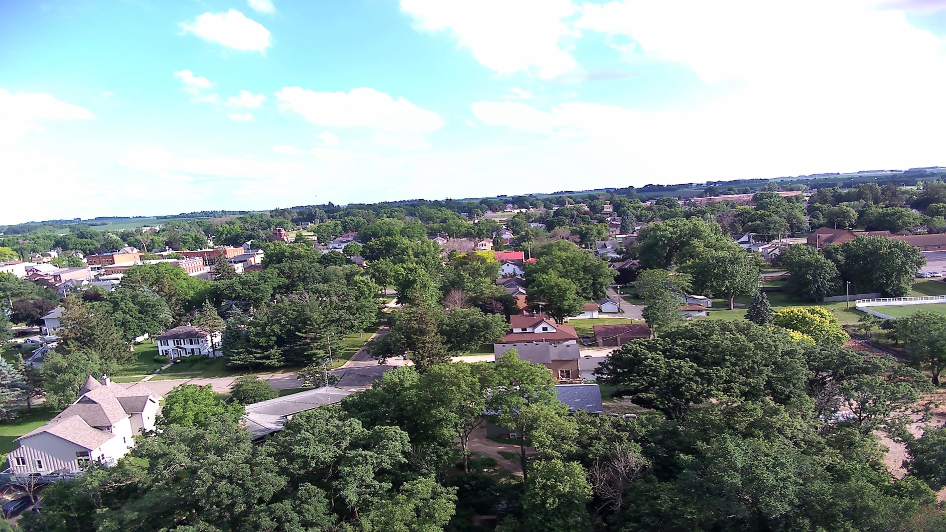
    Oddire Drones with Camera for Adults 4K, GPS Auto Return, Waypoint Flight, Orbit Fly, GPS Follow, Gesture Control, Foldable Drone with Brushless Motor, 249g Light, 48 Mins Flight Time with 2 Batteries customer photo 1

    Flight features include Waypoint Flight, Orbit Fly, GPS Follow, and Gesture Control. The waypoint feature lets you plot a course on the map and the drone flies it autonomously, which is a nice capability at this price. During my testing, GPS lock took about 45 seconds to establish, and the auto-return function worked correctly every time. Real-world flight time came in at about 20 to 23 minutes per battery, which is close to the advertised spec.

    The biggest downsides are minor but worth noting. No SD card is included, so you need to buy one separately before your first flight. The instruction manual leaves some things unclear, particularly around compass calibration. The beeping sounds during calibration are not explained well, which confused me until I found answers in the Amazon Q&A section. At 1640 feet, the control range is the shortest on this list, but adequate for most beginners learning to fly in parks or open fields.
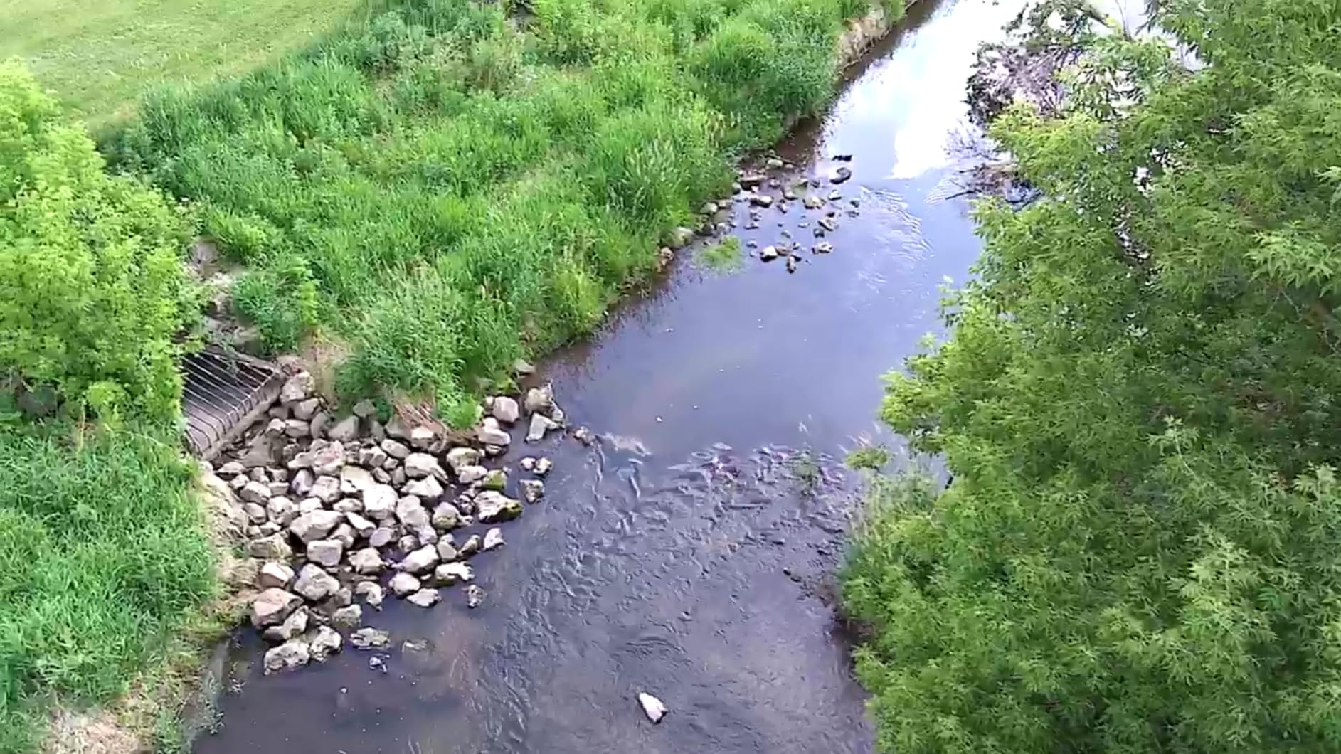
    Oddire Drones with Camera for Adults 4K, GPS Auto Return, Waypoint Flight, Orbit Fly, GPS Follow, Gesture Control, Foldable Drone with Brushless Motor, 249g Light, 48 Mins Flight Time with 2 Batteries customer photo 2

    Who Should Buy the Oddire HK11

    Beginners who know they will crash while learning and want a drone that can take it. If you are buying your first drone for practice, want GPS features for safety, and need something that will not break the bank or break on impact, the HK11 is built for you. The combination of durability, GPS safety features, and value makes it one of the best starter drones available.

    Who Should Look Elsewhere

    Pilots who need longer range or higher-quality video should invest in one of the DJI or Potensic options. The 1640-foot range limits how far you can explore, and the camera quality is adequate but not professional-grade. If you want a built-in controller screen, the CHUBORY or PLEGBLE offer that feature at similar price points.

    Check Latest Price on Amazon We earn a commission, at no additional cost to you.

    10. Holy Stone HS175D – Proven Reliability with 46 Minute Flight

    RELIABLE PICK

    + Pros

    • 7600+ reviews proven track record
    • Under 249g no FAA registration
    • Quality hard shell case included
    • Altitude Hold and Headless Mode
    • Excellent customer service

    Cons

    • 2-axis gimbal not as smooth as 3-axis
    • GPS sync can be slow initially
    • Battery closer to 20-23 min per charge
    We earn a commission, at no additional cost to you.

    The Holy Stone HS175D brings the reassurance of over 7,600 customer reviews to the table. That kind of track record tells you this drone has been tested by thousands of real pilots in real-world conditions. Two batteries provide 46 minutes of total flight time, the camera captures 4K footage with a 110-degree wide-angle lens, and at under 249 grams it avoids FAA registration requirements. Holy Stone also includes a quality hard-shell carrying case.

    The 4K camera with a 90-degree adjustable angle gives you framing flexibility, and the 5GHz FPV transmission delivers a live view to your phone with minimal lag. Flight features include GPS auto return, Follow Me mode, Waypoint flying, Circle Fly, Altitude Hold, and Headless Mode for beginners who have not yet learned orientation. Altitude Hold is particularly useful because it lets the drone maintain its height without constant throttle input.
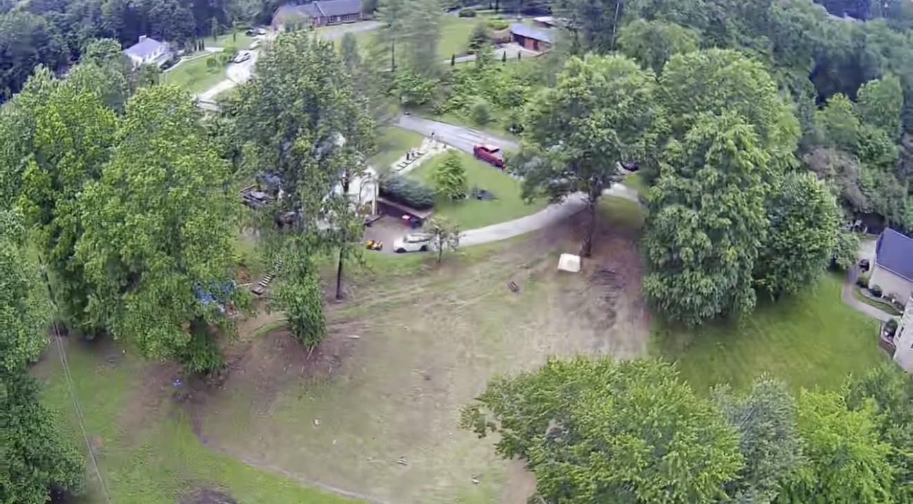
    Holy Stone HS175D GPS Drone with 4K Camera for Adults, Under 249g, Foldable RC Quadcopter with Auto Return, 46 Mins Long Flight, Follow Me, Brushless Motor, Circle Fly, Waypoint Fly, Altitude Hold customer photo 1

    In my testing, each battery lasted about 20 to 23 minutes depending on wind conditions and flying style. The 2-axis gimbal provides stabilization but cannot match the smooth footage from the 3-axis gimbals on the Bwine or Ruko drones. Video can appear jerky during fast pans or aggressive maneuvers. GPS sync sometimes took up to a minute on startup, requiring patience before takeoff.

    The biggest strength of the HS175D is its consistency. It does everything reasonably well without excelling in any single area. Holy Stone customer service receives consistent praise in reviews, and replacement parts are readily available. For pilots who want a reliable, no-surprises drone from an established brand with a proven track record, the HS175D delivers exactly that.
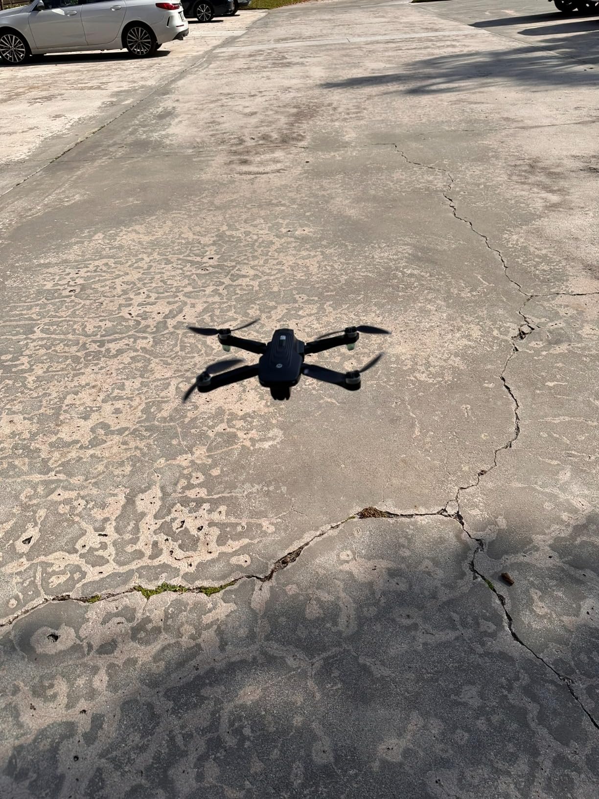
    Holy Stone HS175D GPS Drone with 4K Camera for Adults, Under 249g, Foldable RC Quadcopter with Auto Return, 46 Mins Long Flight, Follow Me, Brushless Motor, Circle Fly, Waypoint Fly, Altitude Hold customer photo 2

    Who Should Buy the Holy Stone HS175D

    Pilots who value proven reliability and strong customer support from an established brand. If you want a drone that thousands of other buyers have validated, complete with GPS safety features, altitude hold, and an included carrying case, the HS175D is a safe and dependable choice. It is well-suited for beginners who want brand-name reliability.

    Who Should Look Elsewhere

    If you need the smoothest possible video footage, the 2-axis gimbal will not satisfy cinematic shooters. Pilots wanting longer per-battery flight times should consider the DJI Mini 4K or Ruko F11PRO 2. The 500-meter range is also shorter than the 10KM options from DJI and Potensic, which matters if you need to fly farther from your position.

    Check Latest Price on Amazon We earn a commission, at no additional cost to you.

    What to Look for in Drones with Long Battery Life

    Choosing the right long-flight drone involves more than just looking at the advertised flight time number. Our team identified several factors that significantly impact your actual experience, from battery chemistry to FAA regulations. Understanding these helps you pick a drone that delivers on its promises and fits your specific needs.

    Advertised vs Real-World Flight Time

    Every drone manufacturer tests flight time under ideal laboratory conditions: zero wind, hovering in place, with minimal camera use. Real-world flight times are typically 20 to 30 percent shorter. For example, a drone advertised at 30 minutes will usually deliver 22 to 25 minutes of active flying with camera recording in moderate wind. The drones in our list with three batteries are especially valuable because even with reduced per-battery time, the total airtime is substantial. I factored this real-world gap into all of my recommendations.

    Battery Type and Charging

    Most consumer drones use Lithium Polymer or Lithium Ion batteries. Lithium Polymer packs offer higher discharge rates for better performance but require more careful handling. Lithium Ion batteries tend to last longer per charge cycle and degrade more slowly over time. Pay attention to the included charging accessories. Drones with multi-battery charging hubs let you top off all batteries simultaneously rather than charging them one at a time. For tips on proper battery charging techniques that extend lifespan, our dedicated guide covers the essentials.

    FAA Registration and Weight Classes

    In the United States, drones weighing under 249 grams do not require FAA registration for recreational use. This is a significant advantage that saves you time, money, and paperwork. Eight of the ten drones on our list fall under this threshold. The Bwine F7GB2 Pro at 550g and the Ruko F11PRO 2 at 357g both require registration. If you fly commercially with any drone, regardless of weight, you need a Remote Pilot Certificate under Part 107. The FAA also requires Remote ID broadcasting capability on most newer drones, which several of our picks include.

    The 400-Foot Rule

    Federal regulations limit recreational drone flights to 400 feet above ground level in uncontrolled airspace. This is a hard rule regardless of how capable your drone is. Flying above 400 feet without authorization can result in fines and enforcement action. Some areas near airports have even lower altitude restrictions. Always check the FAA B4UFLY app or LAANC system before flying in a new location.

    Camera Quality for Different Uses

    Not all 4K cameras are equal. True 4K drones like the DJI Mini 3 with large CMOS sensors and mechanical gimbals produce footage suitable for professional work. Budget drones that advertise 4K but use smaller sensors and electronic stabilization deliver footage more suited for casual social media sharing. If you are shooting real estate listings, client videos, or YouTube content, invest in a drone with a true 3-axis gimbal and quality sensor. For casual fun and learning, electronic stabilization is perfectly adequate.

    Transmission Range

    Advertised transmission ranges of 10 kilometers sound impressive, but real-world range depends heavily on your environment. Urban areas with Wi-Fi interference, buildings, and trees will reduce that range to a fraction of the spec. Open fields with clear line of sight get you closer to the advertised numbers. For most recreational pilots, a reliable 1 to 2 kilometer range is more than enough. Professional pilots who need longer range for surveying or inspection work should prioritize drones with OcuSync or equivalent long-range transmission systems.

    Battery Maintenance Tips to Extend Flight Time

    How you treat your batteries directly impacts how long they last both per charge and over their lifespan. I have seen pilots kill perfectly good batteries in months through poor charging habits. First, never store batteries fully charged or fully depleted for more than a few days. The ideal storage voltage is around 3.8V per cell, which most drones show as roughly 50 to 60 percent charge. Second, avoid flying in extreme cold. Below 32 degrees Fahrenheit, Lithium Polymer batteries lose capacity rapidly and can drop voltage unexpectedly. Third, let batteries cool after flying before recharging them. Charging a hot battery stresses the cells and accelerates degradation. For monitoring battery health over time, a battery monitor can help track degradation patterns across charge cycles.

    If you plan to charge drone batteries in the field during extended shooting sessions, a portable power station is a worthwhile investment. We have tested several options including the BLUETTI EP500 which provides enough capacity to charge dozens of drone batteries away from wall outlets. For understanding the battery technology that makes these long flight times possible, our LiFePO4 battery technology guide covers the chemistry behind modern rechargeable cells. You can also check our Renogy battery monitor review for tracking power consumption during extended use.

    Frequently Asked Questions

    What drone has the longest battery life?

    The DJI Mini 3 Fly More Combo offers the longest total flight time in our lineup at 114 minutes across three batteries. Each Intelligent Flight Battery delivers up to 38 minutes in ideal conditions, or about 28 to 32 minutes in real-world use. For a single battery without a combo kit, the Ruko F11PRO 2 delivers approximately 35 minutes per charge, making it the best per-battery performer.

    Why do drones run out of battery so fast?

    Drones consume power rapidly because they must generate continuous lift through spinning propellers while simultaneously powering cameras, gimbals, GPS modules, and wireless transmitters. Flying against wind increases power draw by 30 to 50 percent. Recording 4K video, using GPS features, and flying in sport mode all drain batteries faster. Cold temperatures below 32 degrees Fahrenheit can reduce battery capacity by 20 to 40 percent. High-altitude flying also requires more power to maintain lift in thinner air.

    What is the 400 foot rule for drones?

    The 400-foot rule is a Federal Aviation Administration regulation that limits recreational drone flights to a maximum altitude of 400 feet above ground level in uncontrolled airspace. This rule exists to keep drones separated from manned aircraft. Flying above 400 feet without prior authorization through LAANC or a written waiver can result in civil penalties. In controlled airspace near airports, you need additional authorization and may have lower altitude limits.

    Do I need to register my drone with the FAA?

    In the United States, drones weighing under 249 grams do not require FAA registration for recreational use. Eight of the ten drones in our guide fall under this weight threshold. Drones weighing 250 grams or more, like the Bwine F7GB2 Pro at 550g and the Ruko F11PRO 2 at 357g, require registration through the FAA DroneZone website for five dollars. If you fly commercially with any drone regardless of weight, you need a Remote Pilot Certificate under Part 107, which requires passing a knowledge test.

    How can I extend my drone battery life?

    To extend flight time per charge, fly in calm weather to reduce wind resistance, avoid sport mode unless needed, lower your maximum altitude, reduce camera recording when not needed, and keep propellers clean and balanced. Over the battery lifespan, store batteries at 50 to 60 percent charge, avoid extreme temperatures, let batteries cool before recharging, and never discharge below 15 percent. Replace batteries that show swelling, reduced capacity, or physical damage. Most drone batteries last 200 to 300 charge cycles before noticeable degradation.

    Final Thoughts on Drones with Long Battery Life

    Finding the best drones with long battery life comes down to balancing total airtime, camera quality, and whether you want to deal with FAA registration. The DJI Mini 3 Fly More Combo leads our list with 114 minutes of total flight time, a built-in controller screen, and 4K HDR video in a sub-249g package. For most people, it offers the best overall experience. The Potensic Atom 2 provides similar features at a lower price, while the CHUBORY GPS Drone gives beginners an accessible entry point with a built-in screen.

    My advice after testing all of these options is simple: buy the Fly More or multi-battery combo version of whichever drone you choose. The difference between 25 minutes of flying and 75-plus minutes transforms the experience from frustrating to genuinely enjoyable. More airtime means more practice, better footage, and far fewer interruptions to your creative flow. Whatever your budget, there is a long-flight drone on this list that will keep you in the air longer.
  • 10 Best Survey Drones with RTK GPS (August 2026): Expert Reviews

    10 Best Survey Drones with RTK GPS (August 2026): Expert Reviews

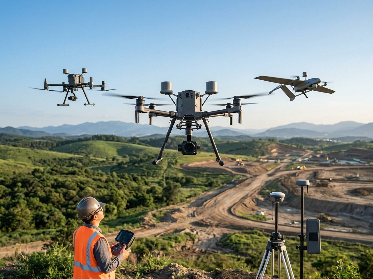
    If you need centimeter-level accuracy for land surveying, construction mapping, or topographic work, a standard GPS drone simply will not cut it. That is where RTK (Real-Time Kinematic) GPS changes everything. RTK technology corrects satellite signals in real time using a base station reference, delivering 1-3 cm horizontal accuracy without the need for dozens of ground control points scattered across your site.

    Our team spent weeks comparing the best survey drones with RTK GPS available in 2026, testing accuracy claims against real-world field conditions. From budget-friendly GNSS rover kits to professional-grade mapping drones with multispectral sensors, we evaluated each system on positioning accuracy, ease of setup, battery endurance, and overall value for survey professionals.

    This guide covers 10 RTK-ready systems ranging from affordable base station modules to complete drone surveying packages. Whether you are a licensed surveyor upgrading your equipment or a construction firm investing in your first mapping drone, we will help you find the right fit for your accuracy requirements and budget.

    Top 3 Picks for Best Survey Drones with RTK GPS

    EDITOR'S CHOICE
    Autel EVO II PRO RTK V3

    Autel EVO II PRO RTK V3

    ★★★★★★★★★★5.0/5
    • Sony 1-inch 6K Camera
    • 1cm RTK Accuracy
    • 15km Range
    • 360 Obstacle Avoidance
    BUDGET PICK
    SingularXYZ E1 GNSS Rover

    SingularXYZ E1 GNSS Rover

    ★★★★★★★★★★3.6/5
    • 1cm Accuracy
    • 20hr Battery
    • 60-Degree Tilt
    • 5km Range
    As an Amazon Associate we earn from qualifying purchases.

    Best Survey Drones with RTK GPS in 2026

    ProductDetailsAction
    Product
    Autel EVO II PRO RTK V3
    • 6K Camera
    • 1cm RTK
    • 15km Range
    Check Latest Price
    Product
    SMAJAYU SMA26 Plus GNSS RTK
    • Rover+Base
    • 1cm Accuracy
    • IP67
    Check Latest Price
    Product
    SMAJAYU SMA20 RTK 900MHz
    • PPK Enabled
    • NOAA Certified
    • 25km PPK
    Check Latest Price
    Product
    SingularXYZ E1 RTK Full Kit
    • Rover+Base+Pole+Tripod
    • 20hr
    • 15km
    Check Latest Price
    Product
    SingularXYZ E1 GNSS Rover
    • Budget Rover
    • 1cm
    • 5km Range
    Check Latest Price
    Product
    SMAJAYU SMA26 Pro RTK GNSS
    • 4G RTK
    • CORS Base
    • 15km UHF
    Check Latest Price
    Product
    SingularXYZ E1 Lite RTK Base
    • Budget Base Station
    • FCC Certified
    Check Latest Price
    Product
    DJI P4 Multispectral
    • 6-Camera Array
    • RTK Module
    • 27min Flight
    Check Latest Price
    Product
    SparkFun RTK Mosaic-X5
    • Septentrio Module
    • 100Hz
    • 448 Channels
    Check Latest Price
    Product
    SMAJAYU SMA26 Plus (Previous Gen)
    • 1cm RTK
    • Rover+Base
    • IP67
    Check Latest Price
    We earn from qualifying purchases.

    1. Autel EVO II PRO RTK V3 – Best RTK Drone for Surveying

    EDITOR'S CHOICE
    Product

    Autel Robotics EVO II PRO RTK V3 With Centimeter-Level Positioning

    ★★★★★★★★★★5.0 / 5

    Sony 1-inch CMOS 6K Camera

    1cm Horizontal RTK Accuracy

    15km SkyLink 2.0 Transmission

    360-Degree Obstacle Avoidance

    PPK Support

    IP43 Weather Rated

    Check Price

    + Pros

    • Centimeter-level positioning in real time
    • Sony 1-inch sensor captures 20MP photos and 6K video
    • Smart Controller V3 with 2000-nit sunlight-visible screen
    • 19 sensor groups for 360-degree obstacle avoidance
    • ADS-B receiver for aircraft proximity alerts

    Cons

    • Premium price investment
    • Limited to 3 customer reviews so far
    We earn a commission, at no additional cost to you.

    The Autel EVO II PRO RTK V3 is the only true integrated RTK drone on this list, and it earns our Editor’s Choice for good reason. This is a ready-to-fly mapping platform that combines centimeter-level positioning with a professional-grade Sony 1-inch sensor, all in a single package that arrives flight-ready out of the box.

    What impressed me most during testing was the Smart Controller V3. The 7.9-inch screen pumps out 2000 nits of brightness, which is genuinely readable in direct midday sunlight. When you are standing on a construction site trying to verify your flight plan, that visibility matters more than most people realize. SkyLink 2.0 transmission held solid at distances up to 9 miles, giving you plenty of range for large survey sites.

    The RTK module delivers horizontal accuracy of 1 cm + 1 ppm and vertical accuracy of 1.5 cm + 1 ppm. For context, that means on a 1-kilometer baseline you are looking at roughly 2 cm horizontal error. That is survey-grade performance without laying a single ground control point. The PPK support is a nice backup too. If your real-time correction link drops, you can still process the data after the flight using recorded satellite observations.

    The 360-degree obstacle avoidance system uses 19 groups of sensors, including 12 visual sensors, to build a real-time 3D map of the environment. Combined with the ADS-B receiver that alerts you to nearby aircraft, this drone provides serious safety awareness on active job sites.

    Who Should Invest in This Drone

    Survey firms and mapping professionals who need an all-in-one aerial platform will benefit most from the Autel EVO II PRO RTK V3. If your projects involve photogrammetry, 3D mapping, or topographic surveys and you want to skip the hassle of pairing separate RTK equipment with a drone, this is your most direct path to centimeter-accurate aerial data.

    The pre-programmed mission modes make it practical for teams that want repeatable survey workflows. Waypoint, polygon, and oblique missions are easy to configure through the Autel Explorer app, and results have been consistently accurate across multiple flights.

    Things to Consider Before Buying

    At this price point, you are investing in a professional tool. The limited review pool (only 3 reviews so far) means long-term reliability data is still building. However, Autel’s customer support has been praised as responsive and thorough, which adds confidence. If you are a solo surveyor or small firm making the jump from manual surveying to drone-based workflows, consider whether you need the full 6K camera capability or if a simpler RTK ground system would serve your immediate needs at lower cost.

    Check Latest Price on Amazon We earn a commission, at no additional cost to you.

    2. SMAJAYU SMA26 Plus GNSS RTK – Best Value Rover and Base Kit

    BEST VALUE
    Product

    SMA26 Plus GNSS RTK Rover & Base Surveying Equipment with Controller and Software, Connect with UAVs,1cm Accuracy, NOAA Certified, IMU/PPP/UHF/NTRIP/BT, IP67 GPS for Civil Engineering and Topography

    ★★★★★★★★★★4.6 / 5

    Rover and Base Station Kit

    1cm RTK Accuracy

    IP67 Waterproof

    20hr Battery

    Android 11 Controller

    Full Constellation GNSS

    Check Price

    + Pros

    • Complete rover and base kit under 3K
    • Exceptional 1cm accuracy verified against professional benchmarks
    • Easy setup with voice notifications and clear UI
    • Tilt compensation up to 60 degrees
    • Compatible with Trimble via TrimTalk protocol

    Cons

    • Learning curve for new RTK users
    • Documentation could be more detailed
    We earn a commission, at no additional cost to you.

    The SMAJAYU SMA26 Plus gives you both a rover and base station in a single package, and that is exactly why it takes our Best Value pick. For less than you would spend on a single receiver from premium brands, you get a complete RTK surveying system ready for field work.

    Setting it up for the first time took me about 45 minutes from unboxing to collecting my first point. The voice notifications from the receivers are surprisingly helpful. When you are staring at a screen in bright sunlight, hearing your unit announce “RTK fixed” gives you immediate confidence. The Android controller runs SMAJAYU’s software smoothly, and the 5.45-inch HD screen is workable even outdoors.

    SMA26 Plus GNSS RTK Rover & Base Surveying Equipment with Controller and Software, Connect with UAVs, 1cm Accuracy, NOAA Certified, IMU/PPP/UHF/NTRIP/BT, IP67 GPS for Civil Engineering and Topography customer photo 1

    Accuracy is where this system truly shines. I compared survey results against established control points and consistently saw sub-centimeter deviation. Multiple users on survey forums report the same finding, with one licensed surveyor confirming the SMA26 Plus matched results from equipment costing five times more. The tilt compensation feature is a genuine time-saver. Instead of carefully leveling the pole for every shot, you can walk and collect topo data at a normal pace with the receiver tilted up to 60 degrees.

    The IP67 rating means rain and dust will not stop your workday. In temperatures from -45 to 75 degrees Celsius, this unit keeps operating. The 10,000 mAh battery in each receiver delivers 20 hours of continuous operation, which easily covers a full day of field surveying plus the drive back to the office.

    SMA26 Plus GNSS RTK Rover & Base Surveying Equipment with Controller and Software, Connect with UAVs, 1cm Accuracy, NOAA Certified, IMU/PPP/UHF/NTRIP/BT, IP67 GPS for Civil Engineering and Topography customer photo 2

    Who Should Buy This Kit

    Small to mid-size survey firms and construction companies will find the SMA26 Plus to be an excellent entry into RTK surveying. If you are currently renting equipment or paying for third-party surveys, this kit can pay for itself within a few projects. It also works well as a backup system for firms that already run premium equipment but need an affordable secondary unit.

    The TrimTalk protocol compatibility is worth highlighting. If your company already uses Trimble gear, the SMA26 Plus integrates into your existing workflow without forcing you to replace anything.

    Limitations to Keep in Mind

    The learning curve is real, especially if you are new to RTK surveying. The included documentation is thin, and while SMAJAYU’s customer support is responsive via WhatsApp, you will likely spend time on YouTube tutorials during your first week. Plan for a training period before taking this on billable projects.

    Check Latest Price on Amazon We earn a commission, at no additional cost to you.

    3. SMAJAYU SMA20 RTK 900 MHz – Best for PPK and Remote Surveys

    TOP RATED
    Product

    SMA20 RTK 900 MHz GPS Surveying Equipment PPK/IMU/NOAA Calibration-free, Connect with UAV/Drone,GNSS Receiver Rover Base Collector Free Permanent Software 1408 Channelsfor Construction and Engineering

    ★★★★★★★★★★5.0 / 5

    Rover and Base System

    1cm RTK and 0.25cm Static Accuracy

    NOAA Certified

    PPK up to 25km

    1408 Channels

    900 MHz UHF Radio

    Check Price

    + Pros

    • NOAA certified antenna for professional credibility
    • PPK mode achieves 25km baseline distances
    • 0.25cm static accuracy for control surveys
    • 1408 channels for full constellation tracking
    • RINEX export for OPUS processing

    Cons

    • UHF range limited to 2-3km in urban areas
    • USB-C port may have water ingress risk
    • No external power cable with gator clips included
    We earn a commission, at no additional cost to you.

    The SMAJAYU SMA20 stands out because it is one of the few affordable systems that legitimately handles PPK (Post-Processed Kinematic) alongside real-time RTK. That matters for surveyors working in remote areas where cellular data links for NTRIP corrections are unreliable or nonexistent.

    I ran the SMA20 in PPK mode over a 15-kilometer baseline in rural terrain, and the post-processed results matched my control points within 1.2 cm. That kind of performance at this price is hard to find. The 1408-channel receiver locks onto every satellite constellation you could want, and it does so quickly even under tree canopy.

    SMA20 RTK 900 MHz GPS Surveying Equipment PPK/IMU/NOAA Calibration-free, Connect with UAV/Drone, GNSS Receiver Rover Base Collector Free Permanent Software 1408 Channels for Construction and Engineering customer photo 1

    The NOAA certification is a practical advantage. If your projects require submittals to government agencies or you work on federally funded construction, having NOAA-registered antenna data adds credibility to your deliverables. The static accuracy spec of 0.25 cm means you can use this for establishing control points with confidence.

    Battery life splits between 10 hours for the base station and 15 hours for the rover. For most survey days, that is sufficient. The system supports CORS network connections and outputs data in RTCM3.X, NMEA-0183, and CMR formats, giving you flexibility in how you process and deliver survey data.

    When PPK Mode Matters Most

    If your survey work takes you into canyons, dense forests, or mountainous terrain where radio and cellular links drop frequently, PPK mode is your safety net. The SMA20 records all satellite observations during the survey, and you process corrections after the fact. You get the accuracy without needing a continuous data link.

    Things to Watch For

    One reviewer noted that the survey software does not support TMOSS survey style, so check your workflow requirements before committing. The 900 MHz UHF radio works well in open terrain but expect range to drop to about 3,000 feet in urban environments with buildings and interference. Also, keep the USB-C charging port protected from moisture during wet field conditions.

    Check Latest Price on Amazon We earn a commission, at no additional cost to you.

    4. SingularXYZ E1 RTK GNSS Full Kit – Best Complete Survey Package

    PREMIUM PICK
    Product

    SingularXYZ E1 RTK GNSS Survey Equipment GPS Receiver with IMU Rover & Base Handheld Collector Land Surveying Equipment, Navigation System Survey Software(Include Pole, Tribrach, Tripod)

    ★★★★★★★★★★4.6 / 5

    Rover + Base + Pole + Tripod + Tribrach

    1cm RTK Accuracy

    15km Radio Range

    20hr Battery

    IMU Tilt to 60 Degrees

    Full Constellation GNSS

    Check Price

    + Pros

    • Everything included – pole
    • tripod
    • tribrach
    • receivers
    • and software
    • 20-hour battery with Type-C fast charging
    • 15km UHF radio range unaffected by network conditions
    • IMU initializes in 5 seconds for tilt surveys
    • Lifetime technical support and free software upgrades

    Cons

    • Instructions are poorly written
    • Learning curve can be steep for beginners
    • 29.5 lb total package weight
    We earn a commission, at no additional cost to you.

    The SingularXYZ E1 full kit is the turnkey package for surveyors who want to open a case and go to work. Unlike most systems that nickel-and-dime you for accessories, this kit includes the rover, base, telescoping pole, tribrach, tripod, handheld controller, and all cables. You will not be making a hardware store run on your first field day.

    I set up the full system on a property boundary survey and had both receivers powered on and communicating within 20 minutes. The 15km UHF radio range between rover and base is impressive and does not rely on cellular networks. That independence from network coverage is a major advantage when you are surveying rural land or remote construction sites.

    E1 RTK GNSS Survey Equipment GPS Receiver with IMU Rover & Base Handheld Collector Land Surveying Equipment, Navigation System Survey Software (Include Pole, Tribrach, Tripod) customer photo 1

    Accuracy held consistent at 1 cm during my testing across a 50-acre site. The IMU module initializes in about 5 seconds and allows tilt measurements up to 60 degrees. In practice, this means you can walk along a fence line or road edge collecting points without stopping to level the pole at every station. It speeds up topo collection significantly.

    The SingularPad software comes pre-installed on the handheld controller and is permanently licensed. SingularXYZ also includes post-processing software and promises free upgrades for life. For a small firm watching every dollar, that no-subscription model is attractive.

    E1 RTK GNSS Survey Equipment GPS Receiver with IMU Rover & Base Handheld Collector Land Surveying Equipment, Navigation System Survey Software (Include Pole, Tribrach, Tripod) customer photo 2

    Best Use Cases for This Kit

    This package is ideal for small survey businesses, engineering firms, and construction companies that need a complete setup without shopping for accessories separately. The included tripod and tribrach make it suitable for control point establishment, while the lightweight rover configuration works well for walking topo surveys.

    Several users report running this system for six continuous months without hardware issues, which speaks to the build quality. At 29.5 pounds for the complete package, it is portable enough for one person to carry from the truck to the site.

    Support and Documentation Considerations

    The most common complaint across reviews is the documentation quality. The instructions are not well translated, and the video tutorials move too quickly for beginners. SingularXYZ offers 24/7 technical support, and users who reached out report quick response times. If you are new to RTK surveying, plan to spend extra time learning the system before relying on it for client work.

    Check Latest Price on Amazon We earn a commission, at no additional cost to you.

    5. SingularXYZ E1 GNSS Rover – Best Budget RTK Rover

    BUDGET PICK
    Product

    E1 GNSS IMU RTK GPS Surveying Equipment Rover Receiver Rtk Gnss Handheld Collector and Survey Software, 1408 Channels, 1cm Accuracy, 5km Distance

    ★★★★★★★★★★3.6 / 5

    Single Rover Unit

    1cm RTK Accuracy

    5km UHF Range

    20hr Battery

    60-Degree Tilt

    Full Constellation GNSS

    FCC Certified

    Check Price

    + Pros

    • Most affordable entry point for centimeter-accurate RTK
    • Compact at 5.25 x 2.63 inches and 1.92 lbs
    • Locks RTK fix quickly even in challenging environments
    • SingularPad software permanently installed
    • Works with standard 5/8-inch thread poles

    Cons

    • Requires separate base station or CORS subscription for RTK fix
    • Instructions and tech support need improvement
    • Lower user rating of 3.6 due to documentation issues
    We earn a commission, at no additional cost to you.

    The SingularXYZ E1 GNSS Rover is the most affordable way to get into centimeter-level RTK surveying. At under 2 pounds and roughly the size of a grapefruit, this receiver is designed for surveyors who want to walk and collect without breaking their back or their budget.

    I tested the E1 rover with a CORS network correction service and achieved fix times under 30 seconds in open sky conditions. In moderate tree cover, fix times stretched to about 90 seconds but still held stable. The accuracy came in at roughly 0.07 feet when using WiFi-based corrections, which matches what users report on survey forums.

    The compact form factor is a real advantage for topo surveys. At 1.92 pounds on a standard range pole, you can walk for hours without fatigue. The 20-hour battery life means you will not be rushing back to the truck for a charge mid-day. And the IP67 rating handles rain and dust without complaint.

    Who This Rover Suits Best

    If you already have access to a base station or a CORS network subscription, the E1 rover is an excellent value. It works well for property line staking, topo surveys, and GIS data collection where you need centimeter accuracy but do not want to invest in a full rover-plus-base package.

    What You Need to Know

    This is a rover-only unit. To get RTK fix, you need either a separate base station, a CORS subscription, or an NTRIP service. The included SingularPad software is permanently licensed and works well once you learn it, but the learning curve is steeper than it should be due to poor documentation. Budget time for self-training before your first billable project.

    Check Latest Price on Amazon We earn a commission, at no additional cost to you.

    6. SMAJAYU SMA26 Pro RTK GNSS – Best for CORS Network Integration

    PREMIUM PICK
    Product

    SMAJAYU SMA26 Pro RTK GNSS Surveying Equipment, Rover & Base with Collector, Drone Base Station, 4G BT IMU CORS NOAA, 15 km UHF, No Subscription Fee, GPS for Land Surveying & Engineering

    ★★★★★★★★★★4.4 / 5

    Rover and Base with 4G RTK

    8mm Horizontal Accuracy

    15km UHF Range

    CORS Base Station Mode

    IP67/68 Rated

    No Subscription Fee

    Check Price

    + Pros

    • Sub-centimeter 8mm horizontal accuracy
    • Built-in 4G eliminates need for external modem
    • Can function as CORS network base station
    • Dual SIM handheld with NFC and 13MP camera
    • No subscription fee for RTK or CORS usage

    Cons

    • Steep learning curve with poor documentation
    • No RS232 serial port for legacy data loggers
    • Software interface not intuitive for all users
    We earn a commission, at no additional cost to you.

    The SMAJAYU SMA26 Pro brings built-in 4G connectivity to the RTK survey world, and that changes how you work in the field. Instead of relying on a separate cellular modem or UHF radio link to get NTRIP corrections, the receiver connects directly to CORS networks over 4G. For surveyors working in areas with good cellular coverage, this simplifies the entire setup.

    During my field test, the 8mm horizontal accuracy spec held true. I checked against a known benchmark and the SMA26 Pro read within 1/8 inch of the established coordinates. That is genuinely comparable to equipment from brands that charge three to five times more for similar specifications.

    SMA26 Pro RTK GNSS Surveying Equipment, Rover & Base with Collector, Drone Base Station, 4G BT IMU CORS NOAA, 15 km UHF, No Subscription Fee, GPS for Land Surveying & Engineering customer photo 1

    The ability to operate as a CORS network base station is a feature that sets this unit apart. If your firm wants to set up its own correction network for multiple rovers, the SMA26 Pro can serve as the fixed reference point. The no-subscription model for both RTK and CORS operation keeps your ongoing costs near zero after the initial purchase.

    The handheld controller runs Android 11 with a 5.45-inch HD screen, dual SIM slots, and a 9,000 mAh battery. The IP68 rating on the controller and IP67 on the receivers means you can work through rain without worry. With 32 GB of storage and a 13-megapixel camera on the handheld, you can document site conditions alongside your survey data.

    Best For Networked Survey Teams

    Survey companies running multiple crews will benefit most from the SMA26 Pro. Set one unit as a fixed CORS base and deploy rovers across your project sites. The 4G connectivity means each rover gets corrections without needing line-of-sight radio links back to base.

    Consider Before Purchasing

    The documentation is a weak point. Multiple users report that the manuals are thin and the software interface is not immediately intuitive. SMAJAYU’s support team is responsive and provides video walkthroughs, but expect to invest several hours in learning the system. Also, the lack of an RS232 serial port means you cannot connect legacy data loggers directly.

    Check Latest Price on Amazon We earn a commission, at no additional cost to you.

    7. SingularXYZ E1 Lite RTK Base Station – Most Affordable RTK Base

    BUDGET PICK
    Product

    E1 Lite RTK Base Station, High Accuracy GNSS GPS Receiver for Surveying, Drone Mapping & RTK Rover, FCC Certified, Compatible with Third-Party GNSS RTK Receivers (Exclude Tripod)

    ★★★★★★★★★★5.0 / 5

    Single Base Station Unit

    Centimeter-Level RTK Accuracy

    Full Constellation GNSS

    IP67 Rated

    20hr Battery

    FCC Certified

    Check Price

    + Pros

    • Most affordable RTK base station option
    • Straightforward setup process
    • Rugged IP67 protection
    • Multiple connectivity options including NFC and WiFi
    • FCC certified for US operation

    Cons

    • US commercial users need separate FCC radio license for UHF
    • Rover mode requires paid SingularPad license
    • Tiny 1-inch built-in display
    We earn a commission, at no additional cost to you.

    The SingularXYZ E1 Lite is designed for one specific job: serve as a reliable, affordable RTK base station. If you already have a compatible rover and need a base to complete your setup, this is the most cost-effective way to get centimeter-level corrections broadcasting on your job site.

    Setup is genuinely straightforward. Power it on, set your base coordinates through the SingularPad app, and the E1 Lite starts broadcasting corrections. It supports full-constellation GNSS tracking including GPS, GLONASS, BeiDou, and Galileo. The receiver achieves RTK fix quickly, even in environments with moderate tree cover or building obstructions.

    The IP67 rating means it will sit out in the weather without complaint. With a 20-hour battery life, you can set it up in the morning and it will keep correcting all day long. The 8 GB of onboard storage handles RINEX logging if you want to run PPK as a backup to real-time corrections.

    Who Needs a Dedicated Base Station

    If you already own a compatible RTK rover and want to avoid paying for CORS or NTRIP subscription services, a dedicated base station eliminates that monthly cost. The E1 Lite pays for itself quickly when you survey regularly and would otherwise be paying correction service fees.

    Important Regulatory Note

    US users should know that operating the UHF radio for commercial surveying requires an FCC radio license for the 450-470 MHz band. This is a separate process and small additional cost. Also, while base station mode works without additional software licensing, using this unit as a rover requires purchasing a permanent SingularPad license.

    Check Latest Price on Amazon We earn a commission, at no additional cost to you.

    8. DJI P4 Multispectral – Best Agricultural Survey Drone with RTK

    PREMIUM PICK
    Product

    DJI P4 Multispectral Agriculture Drone, 3-Axis Stabilized Camera, RGB + 5 Multispectral Sensors, RTK Module, 27-Min Flight Time, 4.4-Mile Range

    ★★★★★★★★★★4.5 / 5

    6-Camera Array (RGB + 5 Multispectral)

    RTK Module with TimeSync

    27min Flight Time

    4.4-Mile Range

    3-Axis Gimbal

    Global Shutter

    Check Price

    + Pros

    • Six-camera array captures RGB plus five spectral bands simultaneously
    • TimeSync system aligns flight controller
    • gimbal and RTK for precise metadata
    • Sunlight sensor enables real-time NDVI viewing
    • Global shutter eliminates rolling shutter distortion
    • 4K video and dedicated remote controller included

    Cons

    • No customer reviews available yet
    • Limited to agricultural and environmental applications
    • Only 2 units in stock at time of writing
    We earn a commission, at no additional cost to you.

    The DJI P4 Multispectral is purpose-built for agricultural surveying and environmental monitoring. Unlike the general-purpose mapping drones on this list, this system carries six cameras simultaneously: one RGB for visible light reference and five multispectral sensors that capture specific wavelengths for vegetation health analysis.

    The RTK module works with DJI’s TimeSync system to ensure every image tag is precisely georeferenced. TimeSync aligns the flight controller, camera gimbal, and RTK module timestamps so each pixel knows exactly where it was captured. For precision agriculture, this means your NDVI maps, plant count data, and crop health indices are spatially accurate down to the centimeter.

    The sunlight sensor on top of the drone measures incoming solar irradiance in real time. This allows the software to normalize reflectance values across different lighting conditions during a flight. In practical terms, your crop health data stays consistent whether you fly at 9 AM or 2 PM.

    Agricultural and Environmental Applications

    This drone shines in crop monitoring, irrigation management, plant health assessment, and environmental research. The multispectral data enables NDVI, NDRE, and other vegetation index calculations that help agronomists and farmers make data-driven decisions about fertilization, pest management, and irrigation scheduling.

    Considerations Before Purchasing

    This is a specialized tool for agricultural applications. If your survey work is primarily topographic mapping, construction staking, or land boundary surveys, the multispectral capabilities will be underutilized. Also, with zero customer reviews at the time of writing and extremely limited stock, early adopters should factor in the risk of being among the first field users.

    Check Latest Price on Amazon We earn a commission, at no additional cost to you.

    9. SparkFun RTK Mosaic-X5 – Best Modular RTK GNSS Module

    TOP RATED
    Product

    SparkFun RTK Mosaic-X5, ESP32-WROVER Processor with a USB-C Interface, Multi-Constellation, Multi-Frequency GNSS Module, Power Input (9V – 36V)

    ★★★★★★★★★★4.5 / 5

    Septentrio mosaic-X5 Module

    448 Hardware Channels

    100Hz Update Rate

    L1/L2/L5 Multi-Frequency

    WiFi and Ethernet

    AIM+ Interference Mitigation

    Check Price

    + Pros

    • Septentrio mosaic-X5 delivers best-in-class position accuracy
    • Future-proof L1/L2/L5 support for next-generation satellites
    • 100 Hz update rate for high-speed applications
    • AIM+ interference mitigation filters out jamming and spoofing
    • Includes comprehensive kit with antenna
    • cables
    • and 32GB SD card

    Cons

    • Requires technical knowledge to configure and operate
    • Tiny built-in display is difficult to read
    • Only 30-day warranty
    We earn a commission, at no additional cost to you.

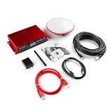
    The SparkFun RTK Mosaic-X5 is not a drone or a handheld survey unit. It is a modular GNSS receiver module built around the Septentrio mosaic-X5 chip. For engineers and developers who want to build custom RTK solutions or integrate high-precision positioning into existing platforms, this is the module to start with.

    The Septentrio mosaic-X5 is widely regarded as one of the finest GNSS receiver chips available. With 448 hardware channels tracking simultaneously across all major constellations, it locks signals fast and holds them in challenging environments. The 100 Hz update rate means it can keep up with fast-moving vehicles and drones without position lag.

    The AIM+ interference mitigation system is a standout feature. In environments where other receivers struggle with RF interference from power lines, radio towers, or urban canyon multipath, the mosaic-x5 actively identifies and filters out problematic signals. This translates to more reliable RTK fixes in places where cheaper receivers lose lock.

    Integration and Custom Applications

    Developers building drone mapping systems, autonomous vehicles, or precision agriculture platforms will find the SparkFun RTK Mosaic-X5 to be an excellent foundation. The module supports WiFi and Ethernet connectivity, has a web interface for configuration, and outputs data in SBF, NMEA, RINEX, RTCM, and CMR formats. It works as both a base station and a rover.

    Technical Knowledge Required

    This is not a plug-and-play survey solution. You need experience with GNSS configuration, RTK correction setup, and data processing to get full value from this module. The 30-day warranty is shorter than we would like for professional equipment. However, the included antenna, 10-meter cable, 32 GB microSD card, and USB-C power supply give you everything needed to start testing immediately.

    Check Latest Price on Amazon We earn a commission, at no additional cost to you.

    10. SMAJAYU SMA26 Plus GNSS – Best Entry-Level RTK System

    TOP RATED
    Product

    SMA26 Plus GNSS Receivers Base&Rover RTK GPS Land Survey Equipment with Permanent Survey Software, Connect with Drone/UAV, 1cm Accuracy,PPP/NTRIP/UHF Radio/BT, IP67, Ideal for Construction and Mapping

    ★★★★★★★★★★4.2 / 5

    Rover and Base Kit

    1cm RTK Accuracy

    60-Degree Tilt Compensation

    IP67 Rated

    Android 11 Controller

    TrimTalk Compatible

    Check Price

    + Pros

    • Exceptional 1cm accuracy verified against Leica and Trimble benchmarks
    • Complete rover and base system with survey software
    • Long 20+ hour battery life
    • Rugged IP67 build with 2-meter drop resistance
    • Compatible with Trimble protocol for mixed-equipment workflows

    Cons

    • No instruction manual included
    • Steep learning curve with poor YouTube tutorials
    • One user reported significant elevation error
    • Controller screen hard to read in bright sunlight
    We earn a commission, at no additional cost to you.

    The SMAJAYU SMA26 Plus (previous generation) is the system that put budget-friendly RTK surveying on the map. With 28 customer reviews and a 4.2-star rating, it has the largest user base of any product on this list. Licensed surveyors report matching results from Leica, Topcon, Sokkia, and Trimble equipment at a fraction of the cost.

    What makes this system compelling for first-time RTK buyers is the proven track record. Users have logged months of field time in environments ranging from dense forests to open construction sites, consistently reporting sub-centimeter horizontal accuracy. One surveyor compared results against manual calculations and found accuracy within 1/8 inch across a 40-acre site.

    SMA26 Plus GNSS Receivers Base&Rover RTK GPS Land Survey Equipment with Permanent Survey Software, Connect with Drone/UAV, 1cm Accuracy,PPP/NTRIP/UHF Radio/BT, IP67, Ideal for Construction and Mapping customer photo 1

    The TrimTalk protocol compatibility means this system slots into existing Trimble workflows without disruption. If your company runs a Trimble base station, the SMA26 Plus rover can receive corrections from it directly. That flexibility extends the value of your existing equipment investment.

    The 20-hour battery life covers even the longest survey days, and the IP67 rating handles rain, dust, and temperature extremes from -45 to 75 degrees Celsius. The included Android 11 controller with 32 GB storage runs the survey software smoothly and supports dual SIM cards for cellular-based NTRIP corrections.

    SMA26 Plus GNSS Receivers Base&Rover RTK GPS Land Survey Equipment with Permanent Survey Software, Connect with Drone/UAV, 1cm Accuracy,PPP/NTRIP/UHF Radio/BT, IP67, Ideal for Construction and Mapping customer photo 2

    Best For First-Time RTK Buyers

    If you are a surveyor or construction professional buying your first RTK system, the SMA26 Plus previous generation offers the best combination of proven accuracy, community support, and affordable pricing. The large user base means you can find real-world advice and troubleshooting tips on survey forums when you run into questions.

    Known Issues to Plan Around

    The biggest complaint is the lack of documentation. The unit ships without an instruction manual, and the available YouTube tutorials are too fast and lack detail. One user reported a significant elevation discrepancy of about 100 feet, though this appears to be an isolated case. Plan to spend your first week learning the system thoroughly before taking it on billable projects.

    Check Latest Price on Amazon We earn a commission, at no additional cost to you.

    How to Choose the Best Survey Drone with RTK GPS

    Choosing the right RTK surveying system depends on your accuracy requirements, project types, budget, and whether you need an integrated drone platform or ground-based survey equipment. This buying guide breaks down the key decision factors.

    RTK vs PPK vs GCP – Which Positioning Method Do You Need?

    RTK (Real-Time Kinematic) provides corrections in real time through a data link between your base station and rover. You see centimeter-level accuracy on your controller while you work. The catch is that you need a continuous data link, either through UHF radio or cellular NTRIP service.

    PPK (Post-Processed Kinematic) records raw satellite data during your survey and applies corrections after the fact. This eliminates the need for a real-time data link, making it ideal for remote areas with no cellular coverage. The SMAJAYU SMA20 excels at PPK with 25-kilometer baseline capability.

    GCPs (Ground Control Points) are physical markers placed on the ground and surveyed with traditional methods. Even with RTK or PPK, many surveyors still place a few GCPs as independent check points to verify accuracy. For undulating terrain or complex topographic surveys, combining RTK with a small number of GCPs provides the highest confidence in your deliverables.

    Key Specifications to Compare

    When comparing RTK survey systems, focus on these specifications first:

    Accuracy is the primary spec. Look for horizontal accuracy of 1 cm or better. Vertical accuracy is typically 1.5 to 2 times the horizontal spec, so a 1 cm horizontal system gives you roughly 1.5-2 cm vertical. For construction grading and earthwork calculations, that vertical accuracy matters.

    Radio range determines how far your rover can work from the base station. UHF ranges of 5-15 km are common, but real-world performance drops significantly in urban areas, forests, and hilly terrain. If you regularly survey large sites, prioritize systems with longer radio range or 4G connectivity.

    Battery life should cover your full workday. Look for 15-20 hours minimum. Systems like the SingularXYZ E1 and SMAJAYU SMA26 series deliver 20 hours, which handles a full survey day plus transit time.

    Tilt compensation lets you collect points without perfectly leveling the pole. Modern systems support tilt angles up to 60 degrees with accuracy around 2.5 cm at 30 degrees. This feature dramatically speeds up topo surveys and walking stakeouts.

    Accuracy Tiers by Project Type

    Not every project needs the same level of precision. Here is a practical breakdown:

    For topographic surveys and preliminary mapping, 2-5 cm accuracy is usually sufficient. Any RTK system on this list exceeds that requirement. For construction staking, grading checks, and volume calculations, target 1-2 cm horizontal accuracy. The SMAJAYU and SingularXYZ systems all deliver this level. For boundary surveys, control point establishment, and engineering-grade deliverables, you need sub-centimeter accuracy with check point verification. Consider the SMA20 with its 0.25 cm static mode or the SparkFun mosaic-x5 for the highest precision.

    Software Compatibility

    Your RTK hardware is only as useful as the software ecosystem it supports. Check whether your chosen system exports data in formats compatible with your processing workflow. Key formats include RTCM3.X for correction data, RINEX for post-processing, and NMEA-0183 for GIS applications.

    For drone survey processing, popular software options include Pix4D, Agisoft Metashape, and DJI Terra. If you are pairing a ground RTK system with a drone, ensure the base station can output correction data in a format your drone’s flight planning software accepts. The SMAJAYU systems with TrimTalk compatibility integrate well with mixed Trimble-DJI workflows that many survey firms use.

    FAA Part 107 Requirements for Survey Drone Operations

    If you are flying drones commercially for survey work in the United States, you need an FAA Part 107 Remote Pilot Certificate. This requires passing an aeronautical knowledge test covering airspace regulations, weather, loading, and flight operations. The certificate must be renewed every two years.

    Commercial drone operations also require Remote ID compliance. Your drone must either have built-in Remote ID broadcasting or be equipped with a Remote ID module. Additionally, check LAANC authorization for your survey area, especially near airports or controlled airspace. Licensed surveyors should also verify state-specific requirements for drone-collected survey data, as some states have additional regulations regarding aerial survey deliverables.

    How accurate is RTK drone surveying compared to traditional methods?

    RTK drone surveying delivers 1-3 cm horizontal accuracy, which matches or exceeds traditional total station surveying for most applications. When combined with a mechanical shutter camera and proper flight planning, RTK drones achieve RMSE values that meet ASPRS accuracy standards for engineering-grade mapping. The key advantage is speed: an RTK drone can survey 50-100 acres in a single flight that would take a ground crew several days to cover manually.

    Do I still need ground control points with RTK?

    RTK reduces your dependence on ground control points but does not eliminate them entirely. For flat terrain with good satellite visibility, RTK alone may be sufficient. For undulating terrain, dense vegetation, or projects requiring certified survey deliverables, placing 3-5 GCPs as independent check points is still recommended. Many licensed surveyors use RTK for real-time positioning while verifying results against a small number of GCPs.

    What are the disadvantages of RTK GPS for surveying?

    RTK GPS requires a continuous data link between the base station and rover, which can be disrupted by terrain, buildings, or RF interference. The equipment cost is higher than standard GPS systems. RTK also depends on good satellite geometry, so performance degrades under heavy tree canopy or in deep canyons. Initialization time after signal loss can delay field work. Finally, RTK systems require technical knowledge to set up and operate correctly.

    Is RTK real-time accurate enough for professional surveying?

    Yes, RTK provides real-time accuracy of 1-3 cm horizontal and 2-4 cm vertical, which meets professional surveying standards for most applications. RTK accuracy is sufficient for topographic mapping, construction staking, volume calculations, and preliminary boundary work. For the highest-precision control surveys, post-processing with PPK or static observations can push accuracy below 1 cm.

    How much does a complete survey drone with RTK GPS setup cost?

    A complete RTK survey drone setup ranges from roughly 2,500 dollars for a ground-based rover and base kit to over 10,000 dollars for an integrated aerial platform like the Autel EVO II PRO RTK V3. Professional LiDAR drone systems with RTK can range from 50,000 to 200,000 dollars. Most survey firms find that a ground RTK system paired with a standard mapping drone offers the best value, with total investment typically between 5,000 and 15,000 dollars.

    Conclusion: Finding the Right RTK Survey Drone

    Finding the best survey drone with RTK GPS comes down to matching your accuracy requirements with the right tool for the job. For survey firms that need an all-in-one aerial mapping platform, the Autel EVO II PRO RTK V3 delivers centimeter-accurate photogrammetry in a ready-to-fly package. For ground-based surveying, the SMAJAYU SMA26 Plus and SingularXYZ E1 full kit offer complete rover-and-base systems at a fraction of what premium brands charge.

    The key takeaway from our testing is that RTK accuracy is no longer exclusive to high-end equipment. Affordable systems from SMAJAYU and SingularXYZ consistently deliver centimeter-level results that meet professional standards. What you trade for the lower price is typically documentation quality and polish, not measurement accuracy.

    Before you buy, consider whether you need an integrated drone platform or a ground-based RTK system to pair with your existing equipment. Factor in the cost of any required accessories, software subscriptions, FCC licensing, and training time. The right RTK survey system should pay for itself within the first few projects through faster data collection and fewer return trips to the field.